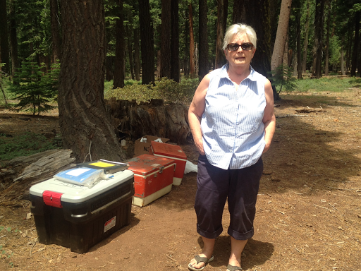
Tuesday, June 30, 2015

Day 75 - Old Station & Subway Cave

Monday June 29

The birds start singing the minute it starts to get light. This morning it was at 4:45. Willie was ready a few minutes before I was, so I had to gobble up my pastry as I headed out of camp. 

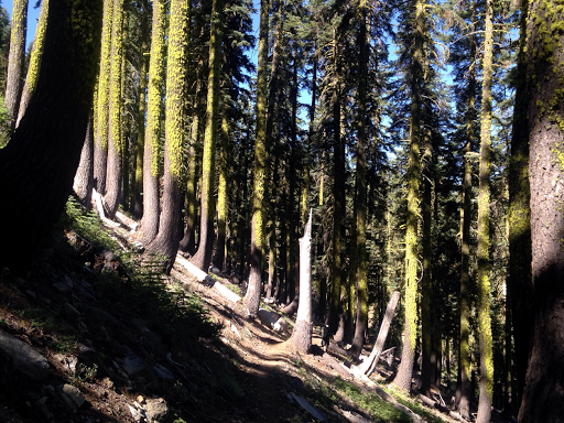
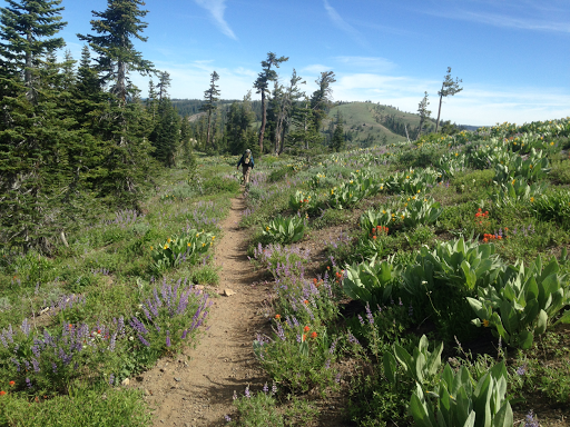
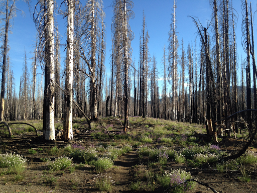
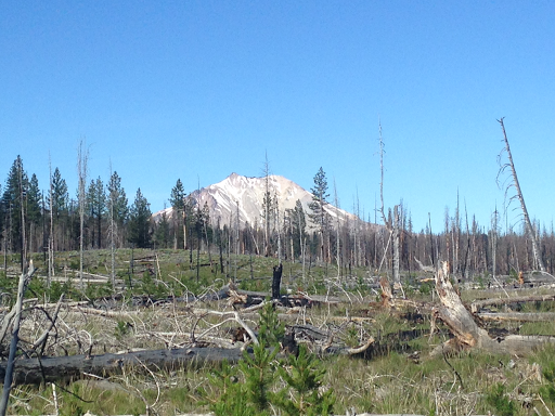
For the first several hours, the trail was really flat and soon passed into an area where the trees were all burned by the Reading Fire in 2012. The fire was caused by lightning.


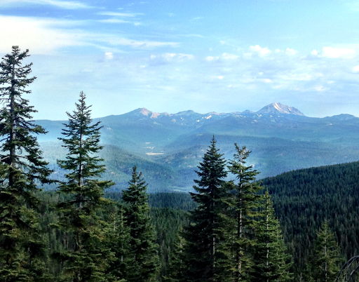
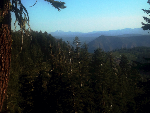
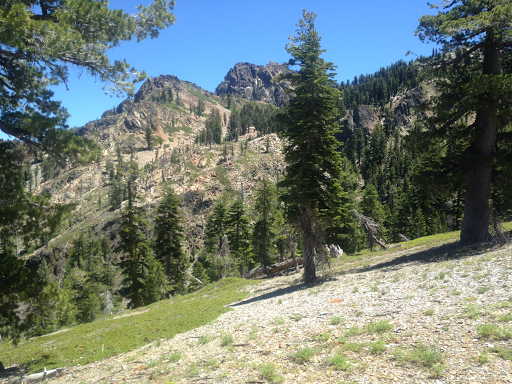
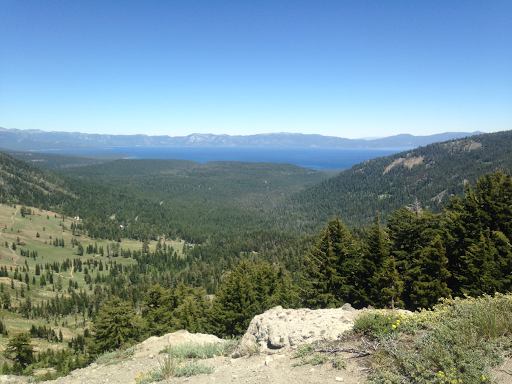
By late morning, there we good views of Lassen.


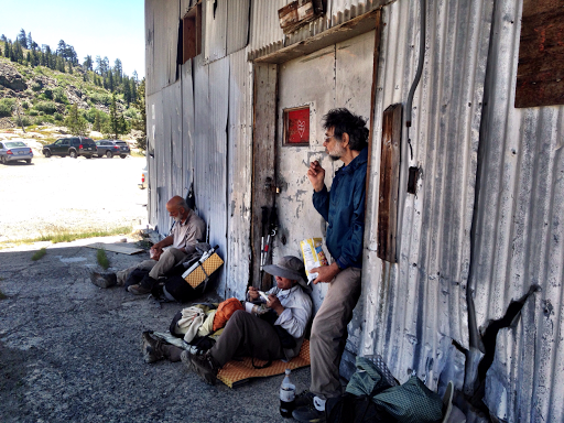
We hurried down the trail at midday as the temperature pushed into the 90's. Our destination was Old Town, which has a grocery store, restaurant and post office. We arrived at 1:30, envisioning a juicy hamburger and cold drink. To our surprise, the "restaurant" was a deli in the grocery store. The deli was closed!  The grocery store did have cold soda and a few snacks. We were told that we should go down the road to JJ's Cafe. It was only three miles away but closed in two hours. It might as well have been 30 miles away. 

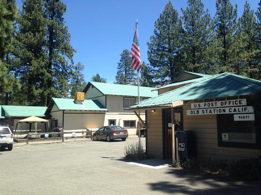
This is what Old Station looks like from the road.


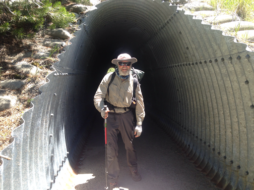
Willie and I decided to hike another three miles to the Subway Cave. The cave is a lava tube that can be explored. The average temperature inside the cave is 46 degrees! 

We stopped at the picnic area and fixed dinner. We refilled our water bottles and got extra water for tomorrow's hike around the Hat Creek Rim, which has no water for 30 miles!  In addition, there is little shade and daytime temperatures can reach into the upper 90's. Some consider this the hottest section of the trail. 

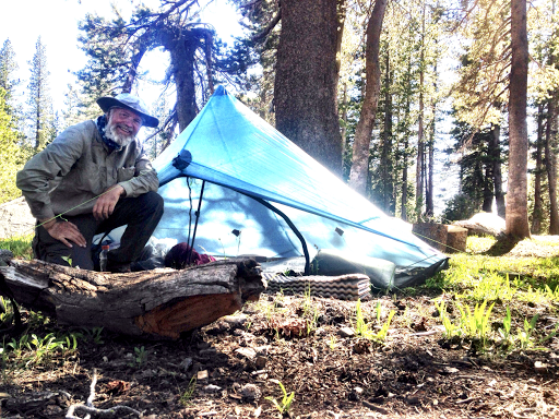
I am stealth camped tonight near the Subway Cave picnic area, at about PCT mile 1381.7. The elevation here is 4,215 feet. 

Day 74 - Lassen Volcanic National Park

Sunday June 28

Chester was a fun town to visit. The stores were close by and the food was good. I'm glad Willie had the idea to stop here. 

I had two breakfasts. The Kopper Kettle had a wonderful Denver omelette and the Best Western had a good selection for their Continental breakfast. I called Pipers Mom, the local trail angel, and she took us to the trailhead. Cut-Finger and Caboose got a ride as well. 

Since we didn't start hiking until 8:45, we weren't sure how many miles we could do. However, it was partly cloudy, so the temperature would be lower. Much of the morning we hiked through forests with few views.


By 11:30, we had hiked nine miles and made it to the North Fork of the Feather River.


We decided to hike to the Kings River, another twelve miles away. That would give us over twenty miles total today and the location has camping next to the river. 

We soon entered Lassen Volcanic National Park. Mount Lassen is the largest plug dome volcano in the world as well as the southernmost member of the chain of Cascades volcanoes The trail passed by Terminal Geyser and Boiling Springs Lake. There was a strong smell of sulfur, and the lake had mudpots, boiling springs, and fumaroles. 


By 4:30 we made it to Kings Creek, having hiked 21.5 miles. That's not bad considering our late start. 

Of note today was the lack of reliable water. I use Guthook's PCT guide which shows reliable sources for water. When we started today, it appeared that water would be found every four to five miles. In reality, it was every eight to ten miles and one "reliable" source (a lake) was more like a soggy mosquito-infested meadow. I always carry around two liters, so I didn't have a problem. But  Willie was almost out of water a couple of times. Hopefully he will carry a bit more from now on. 

I am camped at PCT mile 1356.9. The elevation here is 5,585 feet. 

Saturday, June 27, 2015

Day 73 - Halfway

Saturday June 27

My goal today was to make it to the town of Chester in time to resupply for the next four days. The highway leading to Chester was just over twenty miles away. 

Willie and I were on the trail by 5:15, one of the earliest starts since we have been hiking together. Any earlier and we would have needed headlamps!

There were good views of Mt. Lassen.


The highlight of the day was reaching the halfway point on the trail. Willie and I gave ourselves "high fives".


When we reached the highway, we called "Pipers Mom", a local trail angel, for a ride into Chester. I gave her some money to cover the cost of gas. We got an enormous room at the Best Western.


We had lunch at a local cafe, bought supplies at the grocery store, and had dinner at the Copper Kettle. 

Our hiker friends, Caboose and Cut Finger, came over to celebrate being halfway. 

I currently am at PCT mile 1335.4. 

Day 72 - 4,870 Feet Up

Friday June 26

Last night, Willie said, "Bobaroo, would you be willing to go to the town of Chester in two days to resupply? It would save us from having to carry 6 days of food; we would only need to carry two, and then four from Chester."

I said I'd think about it and let him know in the morning. I decided that I would go to Chester, but I would keep my dinners. I would donate four days of snacks to the hiker box. 

It is not uncommon to change a resupply plan, especially if two people want to continue to hike together. Besides, it is another opportunity to eat town food!

We left Belden at 5:30 AM. It was still in the 70's as Willie and I made our way back onto the trail. The literature we had read said that the trail was "graded", so we expected to make good time. Unfortunately, the trail was fairly steep in some places, overgrown with plants in others, and difficult to find in a few sections. We did manage to gain enough altitude before it began to warm significantly. We reached the top at 11:30, after six hours of steady climbing. We had climbed 4,870 feet!

At the top, we rested along with several other hikers.


From the top, the trail followed the ridge line and often dipped into the forest. We often walked through fields of blooming flowers.


At one spring, these flowers were blooming. I wish I knew what they are. 


It was in the mid-80's again, so hiking was hot and sweaty. Water is still an issue and all of the hikers talk about their plan for resupply. We ended up carrying extra water so we can dry camp tonight. 

Often I am asked, "Why don't you slow down and enjoy the view?" The answer is, we do enjoy the view, but much of our time is spent looking at the trail. There are so many things that can cause an accident: roots, rocks, holes, sticks, gravel on rocks, slippery rocks, mud, trees across the trail, and on and on. And sometimes we have to hunt for the trail! We may miss a view or two, but usually we have many opportunities to take in the beauty. 

I am camped tonight at PCT mile 1315.1. We hiked 25.9 miles today. The elevation here is 6,599 feet. 

Day 71 - Belden

Thursday June 25

"Descent into hell" describes our hike today. The trail dropped down into the town of Belden at 2,210 feet, a drop of 4,100 feet in elevation. The temperature in Belden was almost 100 degrees. It was HOT!

Our hike towards Belden was uneventful except we got our first view of Mt. Lassen in the distance.


We also saw several pretty lakes, this one was Silver Lake.


Both Willy and I had boxes sent to the local trail angels, the Braatens, who host Hiker Haven about a mile out of the town of Belden. 

Our first order of business, however, was to get lunch. We stopped at the Belden Resort Restaurant and had an enormous hamburger. The neatest part was that trail angel "Legend" was there!  He offered to drive us to Hiker Haven to get our boxes! 

We arrived at Hiker Haven just after noon, but no one was there. However, a sign told us to come on in. We found our boxes and I called the Braatens and got permission to take the boxes. We decided to get a room in town, rather than stay with the Braatens. The room in town allowed us to do our shopping and be close to a restaurant and trailhead. 

We got a nice room at the Belden Resort, got all of our additional supplies, did our laundry, and got cleaned up. 

We plan to leave early tomorrow morning with six days of food. The climb out of Belden is 4,100 feet, but it is over the span of 13 miles, so hopefully we can keep up a good pace and get high enough to avoid the 100 degree heat forecast for tomorrow!

Six days of food weights about 12 pounds. I carry 2.5 liters of water, which weighs about 5 pounds. My pack base-weight is about 16 pounds, so my pack will weigh about 33 pounds as I head uphill tomorrow! Wish me strength and stamina!

Wednesday, June 24, 2015

Day 70 - Feather River Canyon

Wednesday June 24

In the evening, I often review my maps to see where I will be hiking the next day. To my surprise, the trail dropped from 5,100 feet to just over 3,000 feet. We were going to drop down to the Middle Fork of the Feather River. 

Willy and I were on the trail by 5:30 and made excellent time due to a clear trail and several miles of downhill. We reached the river just before 9. The bridge was amazing. The bridge is the largest equestrian bridge on the PCT. It was carried into place by helicopter. 


The trail over the river is at 3,076 feet, the lowest elevation on the trail since the Los Angeles Aqueduct. Of course, what that means is a long climb back up. The long climb was 3,000 feet!

On the way up, we crossed Bear Creek on another well made bridge. There were three other through hikers there, also getting ready for the long climb. 


It took several hours and Willy and I stopped a couple of times to get water. The springs are well marked on the map, but they are further apart now. Many are off trail, which means extra hiking. 

The hiking was harder this afternoon because the temperature was in the mid-80's. I was drenched in sweat. I was thankful for the buff that Patti gave me. I would soak it in the stream before putting it on. The cool water around my neck helped cool me down. 

Whenever the trail crosses a road, I look to see if perhaps a trail angel is there. I'm dreaming of juicy watermelon! On the way up to lookout rock, we saw a sign posted by a local trail angel inviting hikers to their cabin. Neither of us had cell service, so we couldn't call. However, when we reached the Big Creek Road, there was a trailer with treats. I had a root beer and an apple. It was wonderful!

After a break, we got extra water and dry camped. I took a sit-bath and feel so much better!

Now for a peek into what I do to set up camp. First, I always make sure I have water. I usually get it before stopping for the evening. 

I next select a flat campsite. Hopefully it's one that has been used before. I also try to find one in the shade. There is nothing worse than trying to relax in a tent that feels like an oven inside. I set up my tent and weigh down the stakes with rocks. I don't want them to pull out if the wind comes up during the night. 

I then unload my pack, putting my mattress, sleeping bag, extra clothes and ditty-bag in the tent. 

I set up my stove, get out my dinner, boil the water and add it to the dehydrated food in my gallon plastic bag. I also make a cup of hot chocolate at the same time. 

While the food is rehydrating, I blow up my air mattress and lay out my sleeping bag. I also hit the "OK" button on my SPOT device.

By this time my food is ready. I find a comfy place to sit and enjoy my meal. Since I never cook food in my stove pot, I put everything away. I keep all of my trash in a gallon Ziplock bag and store it in my food bag. 

Everything then goes into the tent. I try to clean up and then get busy writing my blog. Hopefully I'm asleep by 8. 

I am camped tonight at PCT mile 1269.7. We hiked 26.8 miles today. The elevation here is 5,580 feet. 

Day 69 - The Hill Tops have Trees

Tuesday June 23

Our campsite near Little Jamison Creek must have been popular. At sundown, three other campers set up their tents. Of course, Willy and I left before any one else was stirring about. We hit the trail at 5:30. 

The trail today followed the hilltop ridges. However, most of the hilltops are now forested, so there are few good views out to the surrounding countryside. I did see a mountain with a reflection in a lake. 


Several times we passed through forests where the tree trunks were covered in moss.


In the afternoon the temperature was in the mid-80's. The trail often was lined by flowers. Many different kinds of butterflies would chase each other. Some would seemingly lead the way down the trail.


We leapfrogged with "Double Happiness" and "Dirty Bowl" several times today. I first met Double Happiness just before Idyllwild. 

We now are keeping track of reliable water sources. We carried extra water for dinner, since we knew we would be dry camping. Dry camping means you camp where there isn't a close source of water. 

Now for my commentary on water purification. By far, most hikers use the Sawyer water filter. It is simple to use, but the drawback is that the filter will clog over time and become more difficult to use. In addition, the filter must be protected from freezing. 

A few use the Steri-Pen, which uses ultraviolet light. It is very fast, purifying a liter of water in 90 seconds. The drawbacks are that the unit uses special batteries. In addition, in sunlight it can be hard to tell if the unit is working properly. 

I use household bleach. I put two drops into a liter of water and let it mix for at least an hour. It is very quick to do. The drawback is that some can taste and smell the bleach. It is not a problem for me, and the method has worked well so far. In addition, there is a waiting time before the water can be consumed. I always have an extra liter that has been treated, so I can transfer it to my drinking container. 

I have used the Sawyer mini-filter and became very frustrated with the time it took to do the filtering. I understand that the larger filter works better. 

If I were to give advice, try the Sawyer filter. Also try adding bleach to water to see how it tastes. Do some online research. No method is absolutely perfect. And one more thing, in the desert, I was able to resupply from local water faucets at least 1/3 of the time. You are not always going to be getting water from a stream, pond or water trough!

I am camped tonight at PCT mile 1242.9. We hiked 26.7 miles today. The elevation here is 5,491 feet. 

Day 68 - Up to the Sierra Buttes

Monday June 22

Waiting is difficult. I saw other hikers walking up the street here in Sierra City. They were headed back to the trail. Willy had to wait until 10 for the post office to open to pick up his passport. He needs it to apply for the entry into Canada permit. 

On the plus side, we got to sleep in and had a great breakfast at the Red Moose Inn. I also found out that the grocery store had free Wi-Fi, much faster than the Wi-Fi at the Red Moose Inn. I backed up quite a few pictures from my phone. 

We finally got to the trail at 10:45. The challenge was to climb 2,700 feet up to the Sierra Buttes. This was made more difficult because we had fully loaded packs with four days of food, extra water to go 12 miles to the first reliable source, and a warm day with temperatures in the 80's! What saved us was great trail design. The trail had lots of switch backs, but the slope was gradual. We were able to keep a steady pace and were at the top in two hours.


The Sierra Buttes lie in an area that was subject to gold mining during the California gold rush in the mid 1800's. We didn't see any mines, but there is a paved road leading to the Sierra Buttes trail head. We saw several day hikers. I also understand that there is a lookout at the top, but we didn't have time to make the detour. 

The trail then followed the ridges for several miles and skirts the Plumas National Forest lakes basin. There are many lakes with clear blue water, all nestled in the forest.


We finally decided to camp near Little Jamison spring, since water has been relatively scarce. I had Macaroni and Cheese for dinner. It was even better when I added Fritos!

Now for a bit of insight into the daily trials and tribulations for hikers. One problem hikers sometimes encounter are little gnats, colloquially known as face gnats. They seem to live near oak trees. The little buggers hover just in front of your face as you walk down the trail and will land on your face if you don't swat them away. 

Sometimes there is a cloud of them. I found that if you are able to blow directly on one of them or are able to hit one with your hand, they will fly away. When they are really bad, I would hold my trekking pole in the middle and swing the handle end back and forth in front of my face like a windshield wiper. That kept them away. 

One time when a cloud of them was pestering me, I walked really fast and then suddenly stopped. I laughed when the cloud kept going after my sudden stop! I have never been bitten by one but they sure are annoying!

I am camped tonight at PCT mile 1216.3. We managed to hike 18.8 miles, even with our late start. The elevation here is 7,100 feet. 

Day 67 - Sierra City

Sunday June 21

Happy Fathers Day! Every year I have been going to the annual "beer festival". My family will be there this year too. They promise to drink a toast to the dad on the trail!

Last night two interesting things happened. First, I think I pitched my tent over an ant colony. Somehow they kept finding their way into my tent. I kept unzipping the screen and tossing them out. It was annoying, to say the least, to feel one crawling across my arm as it was getting dark. 

Second, in the middle of the night, I was awakened from a deep sleep by some animal outside the tent. I was so deeply asleep that my muscles wouldn't move, and all I could do was make a slurred "Get out of here!"  Fortunately, the beast ran off before I could move around to see what it was. Needless to say, I was wide awake for a while!

Willy and I were on the trail by 5:30. We had a five mile walk to the Plum Creek campground, and then a three mile road walk to Sierra City.


We stopped at the Red Moose Inn for breakfast and also rented a room for night. The two story building in the photo is a restaurant and an inn.


I did our laundry at the RV park. The local grocery store had adequate supplies. I bought enough food for four days on the trail. 

I bought a deli sandwich for lunch and had a hamburger at the Red Moose cafe. We had dinner across the street at the Buckhorn Cafe. Did you notice that I had two lunches? Yum!

I had a great Father's Day. I had several Rogue "Dead Guy" beers and I even got to soak in the tub to remove the dirt from my feet!

We offered to share our room with some other hikers, but did not get any takers of our offer. 

I was informed that it was "hike naked" day, but by the time I realized it, I was already in town. Sorry, no naked hiking pictures!

We are staying in Sierra City, at the Red Moose Inn, approximately at PCT mile 1197.5. 

Day 66 - Rolling Hills covered in Flowers

Saturday June 20

There were a lot of ups and downs today. Fortunately all were between 600 and 800 feet. The hiking was fast. We had twelve miles by ten o'clock. By the end of the day, we covered 26.3 miles!

It seems like we're in a different "bubble" of people now. As you hike along, you see many of the same people. Today we saw people we've never met before. 

The landscape is very similar to what we've seen the past couple of days - rolling hills with tall trees below and open ridges covered with fields of wooly mules ear, Indian paint brush, lupine and an occasional Mariposa lily.


This is a closeup of the flower that Willy says is a Mariposa lily. I just love them!


We are getting close to the exit to Sierra City, but we decided to stop early and get into town tomorrow morning. We could have pushed and arrived tonight, but it would have meant hiking a 35 mile day. We are not in that much of a hurry. Besides, Willy had his passport mailed to the post office, which won't be open until Monday. 

It was rather warm today, especially as we descend lower. I would guess it was in the low 80's. I was drinking a lot more water, so I needed to watch where the reliable streams were. 

I had a new entrée for dinner tonight - Biscuits and gravy!  Add Fritos and Italian salami and it's a winner! Besides, tonight I got to eat all of the extra food - yummy salami and Fritos. 

Now, if I can just keep all of the ants out of the tent, I will be a happy camper. The ants seem to be everywhere so I must be camped near their nest. 

I am camped tonight at PCT mile 1189.2. The elevation here is 6,389 feet. 

Saturday, June 20, 2015

Day 65 - Up to the Peter Grubb Hut

Friday June 19

Today's hiking consisted of a series of 1,200 foot ascents and descents. Willy and I were on the trail before 6. The trail climbed up and passed the west side of the Squaw Valley ski area, which was the site of the 1960 Winter Olympics. 

The trail then descended. We had an early morning view of the ridge we would be climbing. The trail eventually passed just 300 feet below Tinker Knob, the left-most flattish topped rock outcropping in the picture.


We passed by several lava rock formations like this one.


Around noon we arrived at the Sugar Bowl ski area. Willy was out of water, so he asked a man of there was somewhere to buy a drink. The guy drove us to the town of Soda Springs and returned us to the trail! Wow, more unexpected kindness! When we were dropped off, "Whiskers" and "Half-slow" were taking a break. Willy shared some of his chips with them.


After crossing highway 40, it was 3 miles until we reached interstate highway 80. The trail passed under the freeway through several tunnels.


By 4 PM, I was really tired. I seem to be the weak link with my low energy and reduced stamina. I suggested that we camp near the Peter Grubb hut. The hut is owned by the Sierra Club and can be used for shelter.


We camped nearby. Here is my campsite.


I even have a pink flamingo watching over me!


I am camped tonight at PCT mile 1162.9. The elevation here is 7,870 feet. 

Friday, June 19, 2015

Day 64 - Easy Trail = Big Miles

Thursday June 18

This section, from Interstate 50 (Echo Lake) to Sierra City, is about 105 miles. By hiking a little over 20 miles per day, it should take a little over five days. Yesterday, we hiked about 17 miles. Today we hiked 27 miles!

The trail was relatively easy most of the day, so we made lots of miles. Unfortunately, most of the hiking was in the forest, so there weren't a lot of opportunities for great pictures. 

There was an area with lots of bracken ferns, which were pretty in the sunlight.


The trail also passed through areas with lots of blooming flowers. I wish I knew what they are.


The terrain is rolling hills, so the climbs on the trail are usually fairly easy. 

We climbed to a ridge and could see Lake Tahoe.


Now for a bit of gear review. 
I have the Therma-Rest Neoair air mattress. I bought the full-length one. The mattress has internal baffles to aid in improving the insulating properties. The mattress comes with a stuff sack. 

I love my mattress. It keeps me insulated from the ground, but just as important, it is comfortable to sleep on. The biggest concern is to ensure that no sharp objects come in contact with the mattress. That means keeping the mattress clean and the surface that it comes in contact with. I try to clean off the tent floor before inflating the mattress. I also always roll it up and store it in its storage bag. 

If I were to do it again, I would buy a shorter mattress. My feet could just as easily rest on a stuff sack or my empty backpack. A shorter mattress is lighter and inflates/deflates faster. 

Some people complain that the new mattress is "crinkly". The internal baffles make crunching sounds as you move about on the mattress. This was never a problem for me. Perhaps I was just too tired to notice. The crunching sounds seem to go away over time. 

When I use the mattress, I put my shoes under the top of the mattress to make it elevated. I then use my extra clothes stuff sack as my pillow. It works great!

I am camped tonight at PCT mile 1138.1. The elevation here is 7,438 feet. 

Day 63 - Where's Willy?

Wednesday June 17

Leaving town is always hard. I think it's the food - so good, so yummy, so many calories! Willy and I had breakfast at Bert's Diner before Lailani, a local trail angel, picked us up and returned us to the trail. The help given by trail angels is immensely appreciated. They take time at a moments notice to help complete strangers! Wow!

We headed up the trail at 9. We passed by Echo Lake Resort, which was busy with tourists. There were also a lot of day hikers on the trail. Some were very interested in our through hike, asked a lot of questions, and even took our picture. In this picture you can see both upper and lower Echo Lake.


The trail was pretty easy hiking, but there were a number of trails leading to lakes. On one stretch of the trail, there was a long uphill. I happened to be leading the way and would often pass day hikers. I try to check back every so often to make sure Willy is still within sight. Just after I passed the trail junction to Aloha Lake, I looked back and couldn't see Willy!  I figured he had stopped to get water or to heed the call of nature. I waited and waited and waited some more. Where was he?  

I checked and discovered that I had phone service, so I called him. No answer. 

After waiting 20 minutes, I decided to walk slowly down the trail. Willy is a fast hiker (faster than me); surely he would catch up. I hiked for an hour and still there was no Willy. 

Finally I was talking to a couple of ladies along the trail and happened to mention my predicament. To my surprise, they said, "Oh, we saw him about half an hour ago. He was coming onto the trail from the Aloha Lake trail. He is AHEAD of you!"

Oh my gosh! How could this have happened? Now Willy is racing up the trail trying to catch up with me and has no idea that I am behind him. 

I hiked as fast as I could and kept looking ahead to see if I could spot him. However, with a 30 minute head start, he could be more than a mile ahead. I finally decided that I might have to hike into the evening an check the camping spots along the way. 

Finally as I was scurrying up a hill, I spotted him in the distance! I yelled as loud as I could, "Willy!" He heard my screaming! 

His explanation is a plausible one. He had fallen behind and slipped on some rocks. When he looked up, he didn't see me.  At the trail junction to Aloha Lake, the sign showed that both trails went by the lake. He took the other trail, and I never saw him take it! I guess if something can happen, it will. Fortunately it all ended well!

The only significant climb today was over Dicks Pass, a climb of 1,200 feet. There were good views from the top of the lakes below.


By 4:30 we were both tired. Willy is not accustomed to his new backpack, and I am still breaking in my new shoes. We found some suitable campsites about a half mile from Fontanillis Lake. 

I am camped tonight at PCT mile 1111. The elevation here is 8,361 feet. 

Oh, by the way, did you notice?

Tuesday, June 16, 2015

Day 62 - Resting in Lake Tahoe

Tuesday June 16

I slept in until 7 AM, although I had hiking dreams of heading uphill. I can't remember exactly, but I woke up a bit tired!

Willy's brother in law, Larry, treated us to breakfast at Bert's Cafe. He then drove us across town to Tahoe Sports. I got a pair of Merrell Moab Ventilator shoes. They feel great and have a wide toe box.


My old shoes, Vasque Pendulum trail running shoes, were supposed to last 800 miles from Kennedy Meadows (south). Unfortunately, the sharp Sierra granite and rocky terrain tore up the sides of the shoes in just 400 miles.


I glued on the small pieces of  velcro which hold my gaiters in place. Now my new shoes are ready to go. 

This afternoon, Willy and I went to the Outfitters. Willy bought a new ULA Circuit backpack. It is slightly lighter than his old one. 

I called a local trail angel and arranged for a ride back to the trail tomorrow morning at 8:30. 

We've had a great rest here in South Lake Tahoe and we're ready to hit the trail again!

Now for a bit of gear commentary. For rain gear, I bought Zpack's lightweight and breathable Challenger jacket. I got the version with armpit zippers for extra ventilation. This is a picture of the coat from their website.


I like the coat because it is very lightweight, and the "eVent" fabric allows water vapor to pass through, as long as it is a cool day. 

However, I have one major complaint. The waterproof front zipper is very difficult to get started. I had to try at least a dozen times to get it engaged. It became so bad that I opted NOT to totally unzip the coat. Rather, I left it partially zipped and simply stepped out of it when taking it off. This solution is not satisfactory for me, but at least I can put the coat on without the frustration of trying to engage the zipper. For a coat that costs $290, I feel that the zipper should function correctly. 

I wore this jacket in both snow and rain. When hiking and perspiring heavily, I did get wet from the perspiration, so the "breathability" of the fabric is not 100%, nor is it claimed to be. In the rain, I never wore it long enough to see if it would "wet through", although Zpacks claims the coat to be waterproof. The jacket works extremely well as a windbreaker and the hood has an effective design for rain and wind. 

If I had to make a rain jacket purchase again, I would get something with a better front zipper, even if it meant more weight. I don't know if others have experienced this same problem, but it is extremely frustrating for me.