Wednesday, May 27, 2015

Day 42 - Resting in Independence

Wednesday, May 27

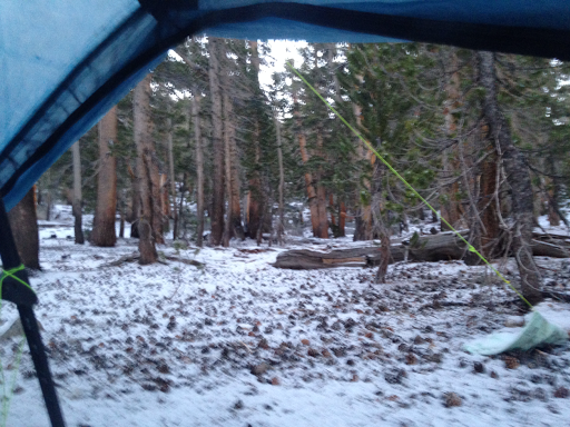
As I have said before, rest days for a through hiker aren't really restful. 

For breakfast, Willy and I had coffee and chocolate cinnamon cake with Jim, the motel owner.

Willy spent much of the morning trying to find an air leak in his Therma-rest Neoair mattress. In the end he couldn't find the leak and decided to send his mattress home. He is going to use a Z-rest pad instead. 

I went through my gear and decided to send home my digital camera and a few other items that I haven't used. The lens on the camera won't retract properly. I mailed them at the Post Office. 

I set out my food and made a shopping list for snack items I needed. We will need a maximum of seven days of food. We will be resupplying at Vermillion Valley Resort, a bit less than 100 miles away. 

We set off mid morning to get breakfast at the local cafe. Unfortunately the cafe was closed on Wednesday, so we had breakfast at Subway. 

On the way back we did our shopping at the Chevron and Shell mini-marts. I must confess that the Chevron store was a disappointment as it had very little selection. Yogi's guide led me to believe that the Chevron was the better store. It wasn't. 

I came back and assembled my food. I finished by loading it into my bear canister. My pack is now ready for tomorrow's hike. 

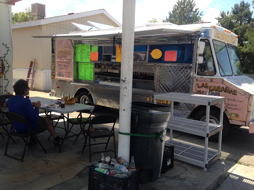
At lunchtime we had real Mexican burritos from the local vendor.


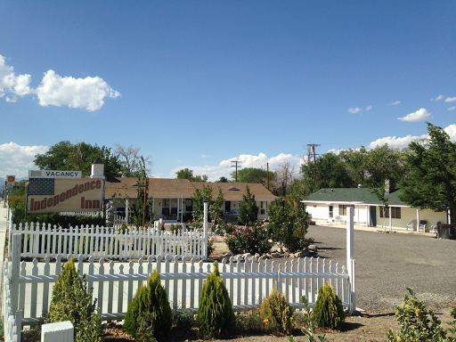
I also took a moment to get a picture of our motel. There are six units and Jim, the owner, was busy installing a central vacuum system.


I called the person who can shuttle us back to the trail. We will be leaving at 6:30 tomorrow morning. 

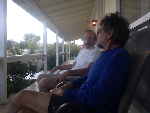
Later this afternoon we shared a few beers with Jim. He told us stories about his former career as a truck driver and about how he got into the motel business.


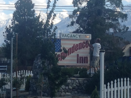
Later in the afternoon, he rented two more rooms and then showed us how he turned on the "No Vacancy" sign - it was all done manually.


Willy and I were going to have a meal at the fancy French restaurant, but it too was closed. What is it with restaurants in this town? We ended up going back to Subway for dinner. 

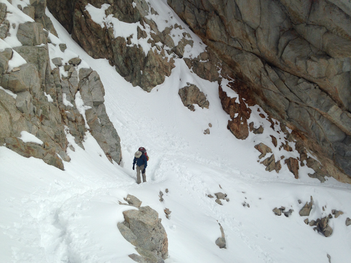
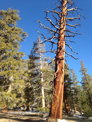
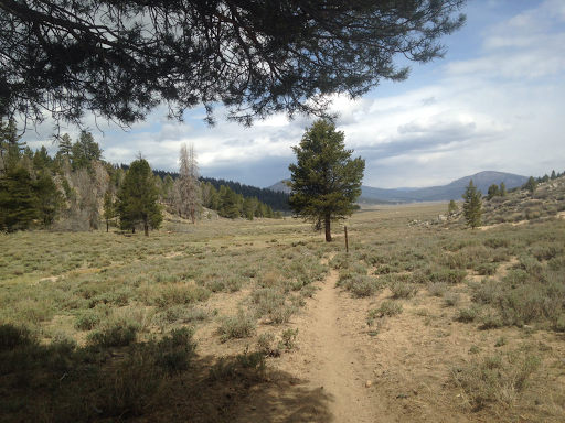
I didn't mention it, but a couple of days ago I managed to do a "turtle" while walking down the trail. A turtle is when you fall down and land on your back with your feet and arms pointed upward. It happened when another hiker was coming up behind me. Instead of stepping off the trail, I twisted my head around and tripped on a rock. Down I went, landing squarely on my back. I had to be helped back to my feet. Fortunately no damage was done other than to my pride!

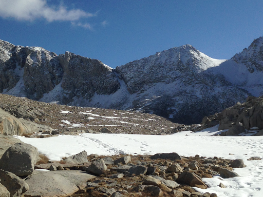
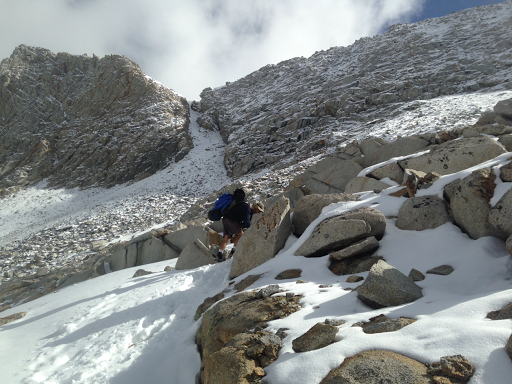
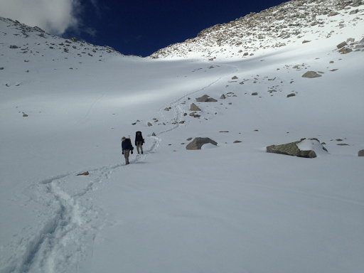
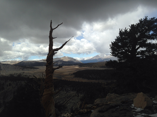
I am feeling very anxious about hiking up 2,000 feet tomorrow to get back onto the trail. Wish me luck and strength!

Tuesday, May 26, 2015

Day 41 - Resupply in Independence

Tuesday, May 26

I knew today was going to be a day for leaving the high Sierras and walking out to the Onion Valley trail head. Willy, Carlos and I needed to get to the town of Independence in order to get food for the next section of our hike. 

We all packed up and hit the trail at 7 AM. I had to carry my tent bundled on top of my pack because the water vapor from my breathing had frozen on the inside of the tent. This has been a problem several times because there is not enough air circulation at night. This was the view from my tent site.


We took the Kearsarge Pass trail. I knew nothing about this trail, other than it led to the Onion Valley trail head. The views were spectacular.


I got a picture of Willy as we headed up to the pass.


As we got higher the views back to the mountains were tremendous.


Within two hours we reached the pass at 11,760 feet.


We needed to arrange a ride from the trail head. It is 13 miles to Independence. Unfortunately the person who we tried to call wasn't answering their phone. We proceeded to go down hoping to find a ride. 

We went down and down and down and down. It took us two hours of fast down hill hiking to get to the trail head. I am very concerned about having to climb back up this trail when we return in a couple of days. On the way down we saw Double Happiness (Casey) and Dirty Bowl. 

When we got to the trail head, there were two guys loading up their truck. They offered us a ride to Independence!


When we got to town, we were walking by the post office. I asked a man standing there where the Courthouse Motel was located. He gave me directions, but said that he was the owner of the Independence Inn and could give us a good deal. He even offered us a ride!


We accepted his offer. Willy and I are sharing a room. Carlos has to head home and was going to hitch hike to Lone Pine. 

We all showered and then had lunch at a nearby Mexican food cart. The food was marvelous!

Jim Getzinger, the owner of the Independence Inn, then offered us a ride to the town of Bishop. Wily needed some gear and we offered to buy Jim his dinner in return for his generosity. 

I got a replacement tip for my trekking pole, some warm sleeping socks and a new fuel canister for my stove. On the way back we stopped at the Courthouse Motel to pick up my resupply package. 

I have to say Jim runs a great establishment and I am highly impressed with his willingness to help PCT hikers!

Day 40 - Highest Point on the Trail

Monday, May 25

I really wondered if I could do it. I've been struggling with the altitude even though I have been at nearly 10,000 feet for several days. And this morning I took to the trail and headed toward a wall of rock and snow. It was only five miles away. 


The trail passes over this wall of rock at a point called Forester Pass. It is at 13,200 feet high. As I got closer, I could see the notch in the rock that I would pass over.


The trail switch backs up the side of the rock wall. Towards the top, a three foot wide path has been blasted from the rock. Of course this entire portion of the trail is completely covered with snow, and footing is difficult because there are semi-frozen footprints from those who have already gone up. I put on my micro-spikes to give me better traction. 

I was really feeling the affects of the altitude. A couple of times I felt light headed. I went slowly and set a goal of walking up one switchback before stopping to catch my breath. 

About half way up, I was amazed at the view to the south.


I finally neared the top and saw the snow chute below the pass.


This is considered to be the most dangerous point because a slip here would send you down to the rocks below. Fortunately the snow was soft and there were deep footprints to follow. Here is Willy crossing the chute.


At the top there was a snow cornice so the trail scrabbled around it. By 10 AM, I was at the top! I was elated!


Moments later Willy and Carlos arrived. We all took time to marvel at the views. This is Carlos (standing) and Willy (sitting).


On the way down the trail was completely covered in snow.


Even with micro-spikes it was slippery. I fell four times but did no damage. After dropping two thousand feet we were once again below the snow line and I was able to remove my micro-spikes. 

The trail continued to descend for five more miles. There are rugged mountains on every side and beautiful streams cascading through the valley. I understand why this is one of the most beautiful places in the world. 

We are going out to the town of Independence tomorrow. We have to take the Kearsarge Pass trail to the Onion Valley trail head where we hope to hitch a ride. 

I am camped tonight at PCT mile 788.6. The elevation here is 10,301 feet. 

Day 39 - Amazing Scenery

Sunday, May 24

I couldn't believe it when I heard snow hitting my tent in the middle of the night. It covered the ground and I was thinking that it was a repeat of yesterday's storm.


I did as much as I could in the tent before climbing out. To my surprise the skies were cloudless!

I headed down the trail at 6:30.


There were several creek crossings but I was able to hop on rocks to get across. 

The views of the mountains on the way were spectacular.


I know I made the right decision about Mt Whitney when I heard that many who tried to summit had to turn back due to snowfall and weather. 

By 10:30 I caught up with Willy and his friend Carlos. I fixed my dinner and hiked much of the afternoon with them. We are headed to Forester Pass which is a little notch in the snowy peaks.


I am camped at PCT mile 774.9. The elevation here is 10,734 feet. 

Day 38 - A Big Decision

Saturday, May 23

Mt Whitney will not be on my itinerary. I'm still feeling the affects of the higher elevation and several times today I felt a bit dizzy. In addition, I heard that yesterday's snowfall kept everyone from summiting the mountain. My body is telling me that I have reached its limits. 

It snowed a little bit last night, but there was no accumulation. What was odd was that there was ice on both the inside and outside of my tent. I made a racket trying to brush it off. The poor lady camped nearby was probably wondering what this crazy PCT hiker was doing! I ended up bundling it up and strapping it to the top of my pack. 

The day started off sunny. I walked through awesome forests of foxtail pines. I understand that this is one of the few places where they grow and that some live to be 2,000 years old. Some have died but are still standing.


The needles on their branches look like a bottle brush.


At 10 AM, I decided to stop and dry out my tent and sleeping bag. I noticed that the clouds were starting to gather again and I wanted dry gear for tonight. 

When I headed up the trail again I was treated to this sight.


The high Sierras are getting closer!

Yesterday I mentioned that I needed some words of encouragement. The picture is difficult to see, but someone had written in the snow, "We're all going to make it this time." I cried.


My plan today was to stop very early, perhaps at Chicken Spring Lake, just 10 miles down the trail. However, I arrived at noon and met several new people and was encouraged to continue. Zombie has a heavy pack and a very slow pace. I followed him for a while and fell better about the pace I have been keeping. 

I also met another gentleman named Willy. 

The views get better and better.


I am camped tonight at PCT mile 758.1. The elevation is 10,471 feet. 

Day 37 - Sierra Snow

Friday, May 22

The snow that fell last night didn't stick but there were frozen droplets on the tent. Unfortunately I didn't sleep well. Even though I had several jackets on, I wasn't warm. The only way I felt somewhat warm was to sleep in a fetal position. Plus I had to get up three times to heed the call of nature. In addition there was a bird that made a "arrack, arrack" call all night long. I could have wrung its neck!

I was on the trail by 6:15 and finished the climb I was too tired to do yesterday. I stopped for water and cooked lunch/dinner at 10:30. It was sunny so I briefly aired out my sleeping bag. But the clouds were moving in. 

The next section of trail climbed back above 10,000 feet. I feel so sluggish and it is getting me down. I am seriously considering NOT climbing Mt Whitney because I am moving so slowly uphill. 

But the big surprise came when it started snowing!  At first it was a few flakes and then it came down in harder and harder. 
I had on my raincoat and rain pants but it put me in a foul mood. Can I really complete this section; this hike? I am moving so slowly and am so tired. Shouldn't it be getting easier to climb hills? I really need some words of encouragement. 

The snow continued for several hours. 
I was worried that it would completely cover the trail. In addition, there is no way to know how long this may last. Could a couple of feet of snow be on its way?

I decided to head to Diaz Creek, about four miles down the trail. About a half mile before getting there, I noticed a lady setting up her tent. There was plenty of space for mine too. 

There was a brief sun break so I got everything set up before the snow started falling again. Hopefully tomorrow will be a better day. 

I am camped at PCT mile 740.9. The elevation here is 9,699 feet. 

Day 36 - Heading into the Sierras

Thursday, May 21

The snow is falling on my tent. It makes a soft but tinny sound. The ground is starting to turn white. It's easy to forget that it's still winter in the high country. 

My morning began as it started to get light, about 5:15. My challenge was to get the bear canister into my pack in a way that would still allow me to pack in everything else. I decided to put it at the bottom of my pack. With a lot of squeezing everything fit. Of course the pack is heavy with seven days of food!

I was headed towards the trail by 6. I got to finish eating a bag of Fritos on the way. They were yummy!

The trail followed the Kern River. I signed the trail register and entered Sequoia National Forest.
It was wonderful listening to the sound of running water. By mid morning the trail leveled off. There was a group of school kids on a field trip asking questions about my through hike. How long had I been hiking? Was I hiking alone?

The trail passed through an enormous meadow named Beck Meadow, and in the distance I could just make out snowy peaks. 
By noon the trail had topped out at 8,000 feet and was dropping back down where it would cross the Kern River. I needed to get water and it was a perfect place to cook lunch/dinner. Other hikers were already there doing the same thing. 
Double Happiness (Casey) arrived shortly after I did. We all ate and relaxed for a bit. There was a lot of discussion regarding how far to hike today, since the next ten miles or so take us over a mountain with the trail topping out at 10,500 feet. 

The trail wound through pine forests. There seemed to be a lot of chipmunks as well. Although I was the first to leave the river, it wasn't long before the rest of the group caught up and passed me. 
The younger generation really has an advantage when it comes to being able to sustain a pace uphill. 

By 4:30 I knew I wouldn't make it to the top, so I found a sheltered nook and set up my tent before it started snowing. 

It is amazingly quiet, now that it has stopped snowing. I can hear some sort of bird squawking in the distance. I should get a good rest unless I freeze. 

I am camped at PCT mile 722.5. The elevation here is 10,236 feet. 

Thursday, May 21, 2015

Day 35 - Resting in Kennedy Meadows

Wednesday, May 20

Sleeping in while on the trail is a luxury. It was 6:30 before I got out of my sleeping bag and headed down to the general store for their all you can eat pancake breakfast. The store owner has an outdoor gas stove where he cooked three pancakes at a time. He served coffee with breakfast as well.


Out behind the store is where everyone camps. There is a giant teepee marking the entrance to the campground area.


I suppose several people could camp inside if they wanted to.

My task for today was to figure out exactly how many days of food I needed to go from here to Independence. The food would have to include a side trip to summit Mt Whitney. I decided seven days of food would be enough.

The difficult task was trying to compact everything to see if it would fit in my bear canister. A bear canister is a container especially made for food storage that keeps bears from being able get to the food. I was able to get four days in the container. The rest I hope to eat early in the next section and hope there are no animal encounters.

I spent most of the day relaxing on the porch of the store.


I sent myself a pair of new shoes so I wore them all day. I also made sure the bear canister fit into my pack.

Several other hikers arrived and left. It's fun to watch the new arrivals get the boxes that were mailed and open them. It was like opening Christmas presents.


I was hoping that More Cowbell would arrive, but he may have ended up talking an extra day in Lake Isabella.

This place is another hiker vortex and I feel anxious about heading out tomorrow. A heavy pack has never been much fun to carry. Fortunately I have estimated lower daily miles for the next section so I shouldn't feel pressure to hurry.

Wednesday, May 20, 2015

Day 34 - 30 Miles to Kennedy Meadows

Tuesday, May 19

A cold beer and people clapping as I arrived. What could be better? That is what happened when Lucky and I arrived at the Kennedy Meadows general store.


The day began at 5:15 as I started packing up. I noticed that my tent had frost on it! I was on the trail before 6 and was rewarded with a beautiful sunrise over the mountains.


I felt anxious because I knew that there would be a strenuous climb to over 8,000 feet. That's a thousand feet higher than the typical climb. How would my legs respond? Would I be able to keep a reasonable pace?

At first the trail was easy as it followed the contour of the hills. I noticed what looked like a small skunk sleeping on the trail.


I was afraid to poke it for fear that it would wake up and spray me! What I found out later is that this was a baby skunk that didn't even have his eyes open yet. He had somehow fallen from his nest. Some other hikers found his nest and returned him to it.

By 9:30 I started up the big climb. My original plan was to stop at Fox Mill Spring to have lunch and get more water. However, it was 11:30 and I realized that I could go to the next water source because I had used very little water. Also, I wasn't really hungry for lunch yet.

I reached the top at 12:30 and my jaw dropped when I saw the view.


The Sierras stretched out before me! Now THAT put some power into my legs!

The trail then dropped down 2,000 feet to the Kern River. I was amazed at how dry and desert-like the mountains were. Also there had been a wildfire some time ago so all of the larger trees were simply skeletons. You might think going downhill would be easy, but I is almost as hard as going up because it works different muscles and you are slowing the weight of a heavy pack. It also can easily lead to twisted ankles or tripping if you take a bad step.

When I reached the bottom, I ran into Lucky, a guy I had met yesterday at Joshua Tree springs. We hiked together as we followed the river towards Kennedy Meadows. The river was a welcome change from the parched land that I have been hiking through.


By 5 PM we arrived at the Kennedy Meadows general store. Lucky bought a six pack of beer and shared with me. We both got our boxes and then headed behind the store to camp.

I am camped tonight at Kennedy Meadows, PCT mile 702.4. The elevation here is 6,133 feet.

Oh, did you notice?


I passed 700 miles since I started this adventure!

Tuesday, May 19, 2015

Day 33 - Double-Pack had an accident

Monday, May 18

A simple misstep. The trail crumbles away. The fall rips a 5 inch gash near the knee. Gear scatters across the trail.

That's what I saw as I rounded a bend in the trail. Double-Pack, a tall burly man, was busy trying to gather his gear that had scattered after the fall. I helped him put everything in order. He was lucky that he only skinned his knee. And he was lucky that his pack didn't pull him down the embankment.

After everything seemed in order, I asked him why he was carrying TWO packs? He said, "I need a lot of food. I have two bear canisters, extra shoes; I just couldn't get the weight down. I carry one pack on the front and the other on my back. They counterbalance each other."

He asked me to hand him his rucksack, which I guess he strapped on top. It weighed more than my pack. All of his gear weighed 140 pounds!

He somehow got turned around and had been heading the wrong direction on the trail. In addition he was totally out of water so I gave him a liter to get him to the next water source.

After all this, I wondered if maybe there was a hidden camera somewhere recording hikers reactions. I do hope he got back on the trail!

Earlier this morning I was happy that it didn't rain last night and it was mostly sunny as I hit the trail at 6. At Walker Pass was a memorial to Joseph Walker who discovered this pass over the Sierra Nevada mountains.


The sunrise was gorgeous as it peeked over the hill.


After helping with Double-Pack, I headed up the trail and saw this amazing mountain of granite.


I feel like I am inching closer to the high Sierras.

I got to enjoy wildflowers again.


By lunchtime I arrived at Joshua Tree springs. They say that the water contains too much uranium, but the water report says it is OK to drink. I'm feeling OK now, and the water tastes good. Here is what the spring looks like.


The rest of the day was warm. Too warm for me as the trail ascended and descended multiple mountains. It was warm enough for this thee foot snake to be on the trail.


You would be proud of me today. I stopped at 4:30 and set up camp. My view:


I am camped at PCT mile 672.9. The elevation here is 6,710 feet.