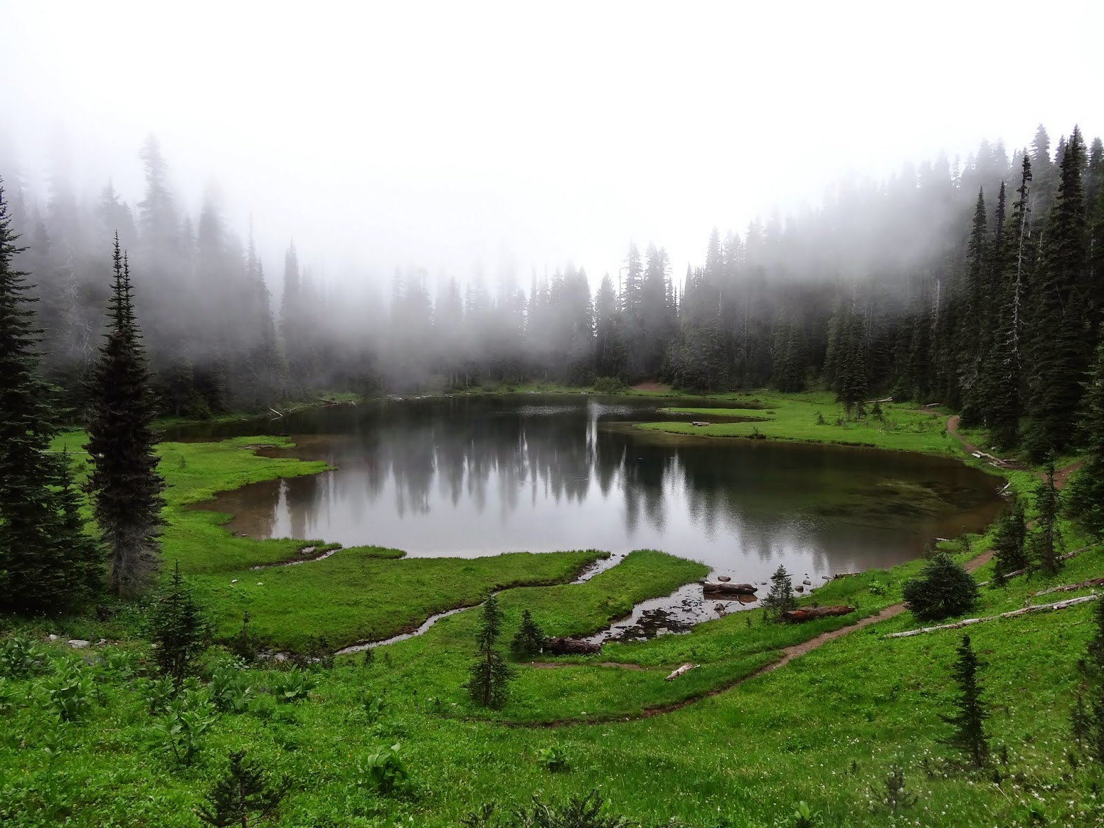
Lake Chelan is the third deepest lake in the United States and the terrain around the lake is rugged and isolated. But the views.... the views are spectacular!
The Lake Chelan Lake Shore Trail is only accessible via the Lady of the Lake ferry. The boat departs from the Lake Chelan Boat Company dock and travels up the lake just over 39 miles, making what is called a "flag stop" at Prince Creek. The boat doesn't normally stop here, but will stop at the request of passengers wanting to depart.
Patti and I had been planning this trip for weeks.
We gathered gear, food, and maps.
We were prepared.
But we were nervous.
You see, this was our first overnight backpacking adventure. It was to be a shake-down to see how well our gear worked. Did we bring enough food? Were we carrying enough water and have the right filtration systems? Did we have good maps so we wouldn't loose the trail? Would we find a good place to camp and would we run into wild scary creatures (bears)?
We planned to split the hike into two days. The first day we planned to hike from Prince Creek to Moore Point. We would camp overnight and then head to Stehekin and meet up with my wife, Valorie, who was staying at the Stehekin Valley Ranch.
The map below shows the plan for the first day of our hike.
 |
| Lake Chelan Lake Shore Trail - Prince Creek to Moore Point |
We arrived at the dock just before 8 AM, picked up our tickets and waited to board the boat at 8:30.
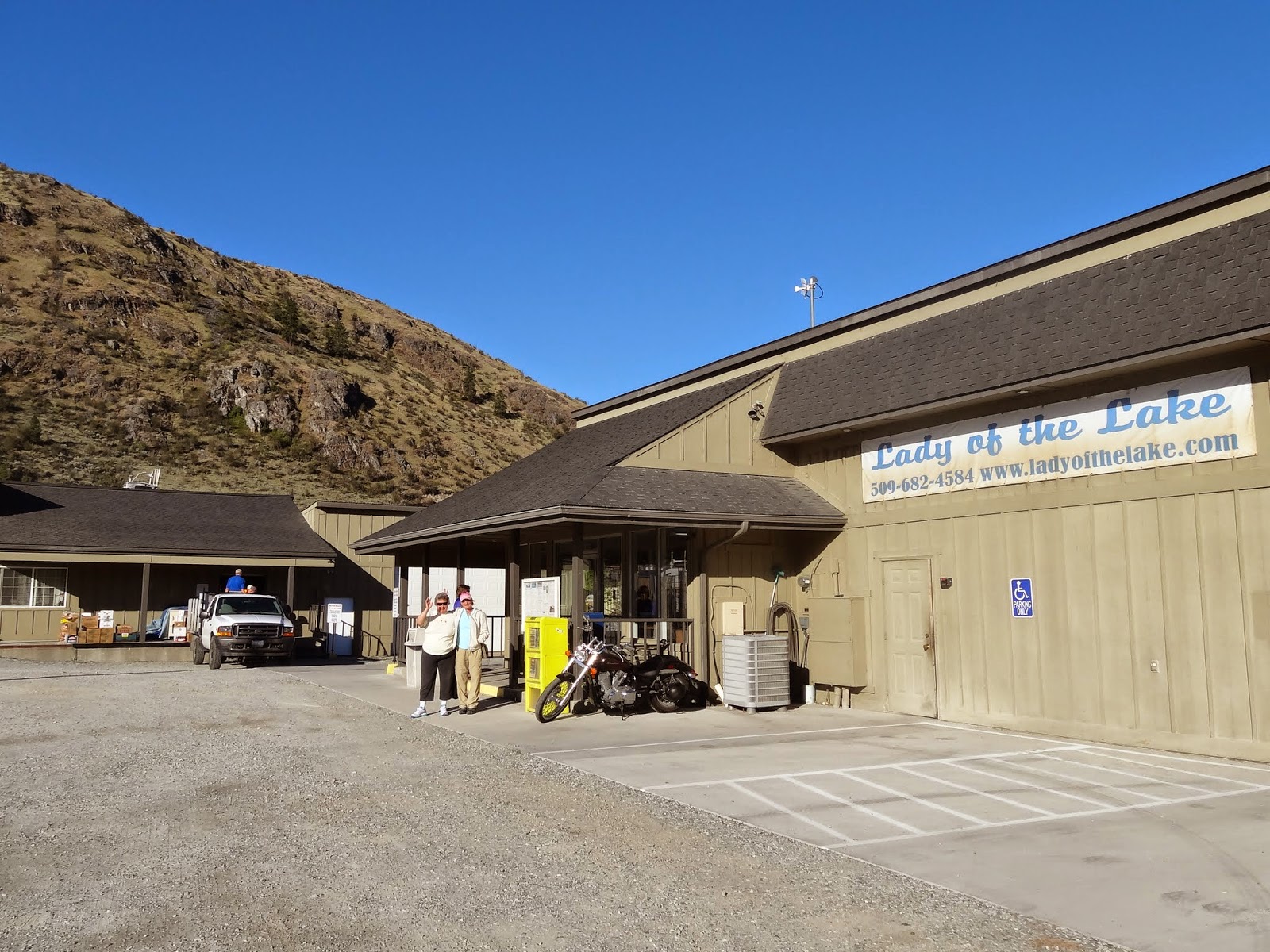 |
| Valorie and Patti waiting for the Lady of the Lake office to open. The day was bright and sunny! |
 |
| Lady of the Lake II - a slower boat but one that makes special "flag stops" along the way |
The ride up the lake was wonderful. The boat captain gave us a history of the lake and pointed out interesting features along the way. There were several other hikers on the boat who were going to depart at Prince Creek along with us. Two gentlemen were going to hike up the hills and take the high-country trails to Stehekin. A couple of younger women and a family were going to hike the Lake Shore trail, just like us. We hoped to see them on the trail.
 |
| Patti talks to other hikers who were departing at Prince Creek to hike the high country towards Stehekin. |
The Lady of the Lake is unique in that the boat can nose its way to shore and let down a ramp to let passengers on and off the boat. After a few hours we arrived at Prince Creek and set our feet on the shore! We were there and excited! Our adventure was starting.
 |
| Valorie takes our picture as we prepare to hit the trail. |
It took us several minutes to get out our hiking poles. By the time we started hiking, the other folks were already out of sight!
We both knew that the timing for the start of the hike was NOT optimal for us. We like to hike in the early morning, and take our naps mid-day! Ha ha! We were starting this trail just before noon, and the sun was hot! But we were happy and excited and looking forward to a great day of walking along the lake.
 |
| Patti on the trail. The views are spectacular. |
 |
| In the distance we caught sight of a couple of the others hiking up the trail. |
As the day progressed, we realized that what we thought was an easy "flat" trail, was in reality a trail with lots of ups and downs. Every time we came near a creek or stream, the trail would drop down, cross the stream, and then head back up. Although the elevation gain was not over 300 feet most of the time, it became difficult for Patti. She was carrying a full pack and the rocks were radiating the heat. We made lots of stops, usually in the shade of a tree or bush. The hours dragged on and I realized we were NOT making the miles per hour that we normally do.
The picture below shows how exposed the trail is to the sun.
 |
| Patti walking up one of the switch-backs. It was hot! |
After crossing one of the small creeks, I caught some movement in the woods. Yep, it was a bear. But not one bear; there were two of them! I tried to get a picture, but they were running fast and disappeared before I could get a picture.
Towards late afternoon, we stopped to look at the map to see how much progress we had made. It was shocking! We were just over half-way to Moore Point, and Patti was really feeling the pack weight in her legs.
To make matters worse, our crossing of Cascade Creek was not pretty. This stream had a large log that I was able to use to cross it, but Patti didn't feel confident to walk it. I remember seeing that hikers often will straddle the log and slide along it, so I suggested that Patti try that. She straddled the log and slid along and made it to the other side. Unfortunately, there were little knobs on the log that cut her leg, so now she had to dig out her first aid kit and apply bandages. She was NOT a happy camper.
It became clear that we were NOT going to have enough energy to make it to Moore Point, so we checked the map and chose Meadow Creek as our destination. Meadow creek had a camp ground and a shelter, so it seemed like a good choice.
I had been trying to stay with Patti as she hiked, but she urged me to hike on ahead at my own pace. She wanted me to "hike my own hike", a common phrase used and accepted in the hiking community. I agreed with Patti, although I was worried about her, since she gets dizzy when she gets tired.
I hiked on ahead. My plan was to get to the Meadow Creek camp ground, find a place to camp, leave my pack, and come back to help Patti the rest of the way. What I didn't consider was that Meadow Creek was the spot that the stream had washed out the trail, so there was a detour. On the way down to the lake, I noticed a flat spot along the stream. It was a good place to make camp.
I left my pack and was headed up the trail, when I hear in the distance, "Hey, Bobaroo!" It was Patti, calling my trail name. I yelled back, "Hey, Patti O!", I called back, using her trail name. She was coming down the trail and glad to be in camp! This is the first time someone has used my trail name! Another first!!
We were both hot and tired. We set up our tents and cooked our dinner. But, for whatever reason, neither of us were hungry. We drank a beer in celebration of the first day, and enjoyed a cup of wine!
 |
| Our camp site along Meadow Creek |
 |
| Our dirt camp - I'm on my sit pad, waiting for water to boil and enjoying a cup of wine |
The next morning we both awoke early. I recharged my iPhone and packed my gear. I fixed a Mountain House "Breakfast Scramble", which tasted good as long as you didn't look at what you were eating!
We broke camp and were on the trail by 5:45.
 |
| Morning sunrise over Lake Chelan. |
I thought we were within a mile of Moore Point, but after hiking for over an hour, I realized that it must have been twice that. It seems that miles on this trail are twice as long as miles during our normal walks!
Yesterday and today, we often walked through burnt out forests, the reminder of several terrible forest fires which swept through this region.
 |
| Burnt out forests from fires several years ago. |
Patti saw another bear on the hill side, but I couldn't catch sight of it.
Patti has the eagle-eyes this trip for sure!
As we neared Moore Point, Patti told me that she was going to flag down the Lady of the Lake and take the boat into Stehekin. Her legs are just not strong enough to take the many hills. I knew this was a good decision, but was worried that she would NOT be able to flag down the boat. She, however, was confident, so we parted ways at Moore Creek. Later she told me, as she walked the trail to the beach, she surprised another bear along the trail. She got a picture!
 |
| Patti got this picture of a bear. It is standing on the large rock. |
This is a map of the rest of the trail from Moore Point to Stehekin.
 |
| Lake Shore Trail map - Moore Point to Stehekin Landing |
The hike from Moore Point to Stehekin was more up and down. The trail rises up to Hunts Bluff just after Moore Creek. It is the highest point on the trail. Patti would not have liked the climb up. However, there were some fabulous views from the top.
 |
| View from the top of Hunts Bluff |
 |
| Barge heading up the lake. |
 |
| Looking up the lake towards Stehekin. |
Along the way, I first heard, and then spotted, a male grouse. His tail feathers were all spread out and he was strutting about.
 |
| Male grouse strutting about. |
As I neared Stehekin, I caught sight of the two women who left the boat with us. They had a good pace going, but I was slowly catching up. All of a sudden, I heard a loud scream and saw them backing down the trail and pointing to the side of the trail. It was a rattle snake! It was coiled and rattling, but we walked on the far side of the trail and let it be.
I arrived in Stehekin at 10:30 and waited for the boat to arrive at noon.
 |
| Restaurant and stores at Stehekin. |
Patti had no problem flagging down the boat. In fact, there were several people getting on the boat there.
 |
| Lady of the Lake landing at Moore Point. |
In retrospect, what did I learn?
Gear:
- I liked my pack, but I have too many little ditty bags stored in the outside mesh pouch. It was hard to find the right bag without taking almost everything out. I felt really disorganized while making camp.
- I did NOT like my Sawyer water filter and filter bag combination. I had switched to a platypus bag, rather than using the Sawyer bag. The platypus bag would not seal properly to the filter and it leaked terribly as I was trying to filter water. I think the platypus bag has a different thread than the Sawyer bag.
- I LIKED Patti's SteriPen water purifier. It only took 90 seconds and worked flawlessly.
- I LIKED my sit pad. It was one of the most useful items at camp and on the trail.
- I did NOT like the freeze dried food. I cooked Spaghetti and meat sauce for dinner, and added dehydrated peas. Although I enjoyed it once before at home, on the trail I couldn't eat more than one bite. I am considering options for going stove-less in the future.
- My tent was difficult to anchor in the rocky ground. Since it is not free-standing, I needed the anchors to keep the tent upright. I ended up piling rocks on the stakes to hold them down. The tent seemed small, but it worked fine. I think I'll like it as I use it more.
- My air mattress worked well, but I had to be careful not to slide off it during the night. Is there some trick to keeping the sleeping bag on the mattress? I managed OK by putting my pack on one side and sleeping close to the side of the tent. Only my feet would slip off.
- My sleeping bag was much too hot to use at first, but as the evening grew cooler it was great to snuggle into. I like the fact that the bag is very light weight and packs away easily.
- My shoes worked very well. I have a pair of La Sportiva trail running shoes. They are not waterproof by design, so that moisture produced while walking has a way to evaporate. I also LOVE my Montrail "enduro-soles" custom moldable insoles. You warm them in an oven for two minutes, put them in your shoes, and they mold to your feet. It feels like I am walking on a cloud!
- I love my hiking shirt and pants. They are sold by RailRiders. My shirt is a Men's Madison River Shirt with Insect Shield and my pants are Men's Eco-Mesh Pant with Insect Shield. They are extremely light-weight, tough, have insect protection, allow a lot of air circulation, and dry quickly. The dirt doesn't seem to cling to them either.
- I was UNABLE to try blogging from the trail. I was surprised at how tired I was at night; I can't imagine how some hikers have the energy to blog every day. Also, since there was absolutely NO reception, it would have been impossible to send a blog had I created one.
- I love my iPhone. I have an iPhone 5C with 32GB of memory. I put the boat schedule and the Stehekin bus schedule information in a notepad file and it came in handy while on the trail.
- I love the Gaia GPS app for my phone. This app allowed me to capture a map of the entire Lake Chelan / Stehekin area and save it to my phone. When on the trail, I just had to open the map and the GPS showed me exactly where we were! It doesn't require cell connectivity and worked like magic!
Physical Preparation:
- I have been hiking every weekend with my pack up trails with significant elevation gain. My legs were strong enough that I enjoyed the ups and downs. Patti, however, had hiked with her pack on weekends, but was not prepared for the elevation gains. What seemed to be an easy hike along the lake was in reality a lot of elevation gain and loss, over and over.
- Heat is a big factor while hiking. It was hot and the trail was exposed. The rocks radiated the heat back from the ground so it was like hiking through an oven.
- Hike your own hike (HYOH) is a great concept. However, I found it difficult to just head on up the trail, knowing that my hiking partner was struggling. I'm not sure how to balance the concern for a partner with the desire to HYOH. I must admit, however, once Patti had made the decision to catch the boat at Moore Point, I really enjoyed the solo hike up the trail.
Other:
- I loved hearing the crickets at night! Constant chirping meant no bears snooping through the camp site.
- I misjudged how far we would be able to hike the first day. I thought it was about eight miles to Moore Point. It was actually 11 miles! I need to pay more attention to mileage on the maps in the future.
- I assumed that Patti was ready for this hike. We should have done a test hike on a few more difficult trails before attempting this hike.
In all, I loved this hike.
I learned a great deal, had a good time, but am sad that Patti had to Section Hike the trail.
Stehekin was paradise for me.
I put my feet on the Pacific Crest trail, ate some of the best croissants from the
Stehekin bakery, and enjoyed walking down the road and having everyone smile and wave!
No better way to end our first adventure!
 |
| Our cabin at Stehekin Valley Ranch. It was wonderful. |