Tuesday, November 25, 2014

5 Months before start - Training, researching, worrying

I just realized today that it is about five months before I will be starting my adventure on the Pacific Crest Trail.

Five months.
It is both a long time and a short time away.

It's been a long time preparing my body.
I have been walking EVERY DAY for the last seven years.
Walking before work.
Walking during my lunch break.
Walking on weekends and on holidays and vacations.
Walking up steps, hills and along wooded trails.

Enchanted sun rise out on the trail

The trail around Oak Lake as the sun rises.


This year, I have averaged 14 miles per day; half the distance of a good day on the trail.
I am happy with my progress.

This morning I followed my normal weekend "walking routine":
I arose early (very early) and walked on the treadmill for two hours.
I set the speed at 3.7 miles per hour on a slope of six degrees.
By the end of my work out, I am drenched with sweat.

I take a short break and remove my shoes and socks.
My feet feel hot to the touch!

After my feet cool off, I put on a new pair of socks and switch to my trail runners.
I grab my pack and hiking poles and head out to meet my walking buddies.
I am fortunate to have friends who like to walk on weekends, rain or shine.
We meet just as it gets light and head for the trails near Lake Sawyer.
My walking buddies have a good pace, and we cover just over six miles in the next two hours.

By 9 AM I will have walked my fourteen miles.

The trail was flooded this morning. I am getting used to walking in wet shoes.

But five months until the start of my PCT hike is a short time as well.

I still need to get the rest of my gear: a light-weight warm jacket, rain pants, and windbreaker.
I need to decide where my resupply towns will be.
I need to determine where to send food, and where to buy it.
I need to decide on my start date.
I need to get food and pack / label boxes.

There are permits to obtain, a plane ticket to buy, and lists / reminders to make.
I need to have my wife take over paying the bills and helping with my blog.

So many things yet to do.

Five months.


Sunday, October 5, 2014

Ulrich Cabin to Snoqualmie Pass on the Pacific Crest Trail

The cabin at Camp Ulrich near the Government Meadows is located about 20 miles east of the town of Greenwater, Washington. The cabin is a common rest stop for Pacific Crest Trail (PCT) through hikers, especially in the fall, when Washington rains and storms and bring nasty wet weather onto the trail. The cabin is a welcome venue to escape from the weather.

The cabin was built to commemorate the life of Mike Ulrich, a forester who died in 1957. There is a plaque which reads,

     The mountain Gods from seat on high,
     Rejoiced to see Mike Ulrich die.
     And at his death gave this decree:
     "to all who pass here, know that we entrust to big Mike Ulrich's hands these camps, these trails,
     these forest lands: to rule, protect, to love and scan as he did while mortal man;
     And deal out sentence stern and just on those who violate his trust."
     Stranger, beware, leave not a fire
     Foul not Mike's camp,
     Rouse not his ire!"

My wife was most gracious, and agreed to drive me on Forest Service road 70 (just beyond Greenwater) to the horse camp near the Ulrich cabin. The road is paved for nine miles, and then is a good gravel road to the turn-around / parking lot. There is a trail from the parking lot that leads to the Pacific Crest Trail.

I arrived at 4 PM and made it to the cabin by 4:45.
Ulrich Cabin at Government Meadows
From the cabin, the trail passes through dense forest to the spot where settlers from the first wagon train using the Naches Trail stopped to camp in 1853. They were headed across the Cascade Mountains to settle in Western Washington. The wagon train consisted of more then 30 wagons. They camped at this spot, resting their oxen, who feasted on the abundant grass and good water supply.
Original camp site of settlers in 1853.
The PCT then winds through the forest and crosses several dirt roads, used for logging. I noticed a truck camper parked half-way up on a hill in the distance, and wondered if perhaps hunters were using that sight to spot elk. I was hoping my attire didn't appear to be elk-like from that distance!

I was surprised when the trail came up to the truck camper that I had seen earlier from the trail.

A lady yelled out the window, "Hey, are you a through hiker?"
I chuckled, and said, "No, but I'm in practice for next year. Does that count?"

An older gentleman then came out and said, "Would you like a beverage or something to eat?"
I had read that PCT through hikers should always reply, "Yes, thank you". So I did.

The couple were through hiker "trail angels".
They are people who camp out along the trail and offer food and comfort to the hikers.
The fellows name was Mike (I think, my memory is a bit fuzzy here) and his wife was named Martha.

I parked my pack and settled back in a soft chair, enjoying a banana and a cold lemonade.

Mike had worked for Weyerhaeuser and knew all of the logging roads in the area. This site was perfect. The view of Mount Rainier was fabulous and there was good cell service.

We chatted for a half hour and I listened to their stories about through hikers. They even hosted "Half Mile", who was walking the trail to map it with his latest GPS equipment.

When I left, I signed their trail register.
Now "Bobaroo", my trail name, is officially in the public record.
I also took their picture:
Trail Angels - Jim and Martha

I headed up the trail and made it to my planned camp site by 6:30.
As a bonus, there was a nearby spring with a good flow of water.
My campsite - just off the Pacific Crest Trail about 6 miles beyond Government Meadows
In the morning, there was a beautiful red sunrise, but it was chilly. I had to wear my jacket for the first hour or so. There were amazing views of Mount Rainier, reflecting the morning sunlight.
Mount Rainier from the Pacific Crest Trail
I came over a hill and was astounded by the forest of dead trees. They had all died from a 3000 acre fire to which a scout group erected a sign.
Forest that was devastated by a forest fire in 1988

Falls Creek Fire - sign explaining what happened
I hiked on for several hours and was a bit concerned about water. This section of trail goes for about 11 miles without a reliable source of water.

I did, however, find a cache left for through hikers.
Cans of Beer!
Realizing that there were very few hikers still on the trail, I took one to enjoy at dinner.
More Trail Magic - cans of beer left along the trail for thirsty hikers
Often there would be views to the hills in the distance.
Autumn has really arrived in the high country.
Beautiful fall colors on the surrounding hills
I almost walked by a "reliable source" of water, except that I noticed a man and woman sitting in a meadow as they cooked their lunch and dried their sleeping bags.

The man turned out to be an avid through hiker who had hiked the PCT three times and both the Continental Divide Trail and the Appalachian Trail!

His trail name was "Freebird" and his partner's trail name was "Raven".

He gave me some tips, including:
1) Start the PCT hike early - either late March or the first week in April.
2) Go SLOWLY for the first month or so. Most new to hiking get hurt by trying to go too far too soon.
3) By going slowly you won't get to the Sierras too soon. It's 700 miles away.
4) Buy your food along the way where possible. Most towns have a great supply of food, and sending food by mail is expensive.
5) Keep in touch with other hikers on the trail. They can offer advice and help to make the journey much easier.

He typically did not treat his drinking water, but did carry a filter.
He also had been foraging for mushrooms and had found some "Chicken of the Woods". It is easy to identify, and adds a meaty flavor to the meal. He gave me some to add to my dinner.
This is what they look like in the wild. Note: it's not my picture.


Unfortunately, I did not get a picture of Freebird or Raven, but will visit his blog on Trailjournals.com.

By 5:30 PM, I made it to Stampede Pass, and within two miles I made it to my campsite.

I had just walked 26.5 miles on the PCT!

Needless to say, I ate a hurried dinner and went to bed just as the sun was setting.
I was exhausted but thrilled with a long day on the trail.
My campsite hidden in the forest about two miles north of Stampede Pass
The next day, I awoke and broke camp just as it was getting light.

The trail wandered through dense forest and often broke out into pretty meadows.
There were hundreds of mushrooms along the trail.
It was almost unbelievable, like something taken from a children's book.

There were Amanita muscaria, those bright red mushrooms which are poisonous.
Amanita muscaria - hundreds of these lined the trail
There were "hedgehog"mushrooms, many different kinds of coral, Boletus edulus (Porcini), Hericium erinaceus, a tooth fungus, also called "lion's mane", Oyster mushrooms, and one of my favorite, the Cauliflower mushroom (Sparassis).


This portion of the trail had much more frequent sources for water. In fact, there was almost too much water. Several times the stream was running down the trail. There were several areas with pretty ponds.
Small pools along the trail
The PCT comes right next to the edge of the Cedar River Watershed. I had to chuckle, because about every twenty feet was another sign announcing that it was illegal to enter the watershed.

One of the few climbs on the trail ended up at Mirror Lake. It was nestled between tall peaks and would be a good camping destination from Snoqualmie Pass or Stampede Pass.
Mirror Lake
By noon I was within five miles of my destination, Snoqualmie Pass. I had told my wife that I would meet her between four and five, thinking that I might take that long if there was a lot of elevation gain. Since the trail had been fairly easy, I called her to say I would be at the pass by 2 PM.

Her reaction? "Oh good Lord!"

However, I kept my promise by taking her whistle with me, so she had to keep hers and pick me up.

I was amazed at how noisy the freeway is from the trail above. It was almost a low roar.
This is the first view of the freeway from the trail.
Looking south at Interstate 90 from the Pacific Crest Trail near Snoqualmie Pass
The last two miles of the trail continue through dense forest and pass several lakes. There were many hikers headed to Lodge lake.

I finally caught sight of Snoqualmie Pass and could imagine how excited through hikers are to see a place to stay and "real" food.
First view of Snoqualmie Pass from the Pacific Crest Trail
What did I learn from this hike:
1) I have proven to myself that I can hike all day, get up the next morning, and do it all again.
2) Physically, the trail is very challenging. I can feel the ache in my leg muscles. I need to keep training to get those muscles in shape.
3) I finally found the right shoes for the trail. I'm wearing Montrail Bajada, size 12.5 (two sizes bigger than my "normal" shoe. No blisters or foot problems this time.
4) Another experienced through hiker suggested buying food along the way during my PCT hike.
5) I used bleach to treat my water (two drops per liter). THAT is going to be my preferred method of treating my water from now on.
6) Still not sure what stove I should use. I like the JetBoil, but the alcohol stove still calls my name.
7) I should consider a slower start to my PCT through hike; that also means an earlier start.
8) I didn't need a whistle the entire trip. However, it was worth the ride home!

I have now officially completed an entire SECTION of the PCT.
Section "I" runs from White Pass in the south, to Snoqualmie Pass in the north, almost 100 miles!

Sunday, September 21, 2014

White Pass to Chinook Pass via the Pacific Crest Trail

The Pacific Crest Trail crosses highway 123 at White Pass and runs north for almost 30 miles to Chinook Pass at highway 410. This section of trail is perfect for a two day overnight hike. My plan was to hike at least to the Mount Rainier National Park border, camp for the night, and then head out to Chinook Pass, where my wife was to meet me at noon on Saturday.

The weather is year, and this month (September), has been fabulous. And the third weekend in September was no exception.

Friday morning started out overcast, but the forecast was for clearing skies and warmer temperatures on the weekend. Unfortunately, I had to work for a few hours in the morning on Friday, so I didn't get home until 8:30 AM. I quickly changed clothes, packed up and headed to White Pass. As I neared the pass, I saw a huge patch of blue sky. When I arrived at 10:45 AM, there was nothing but sunny skies, perfect weather for hiking the PCT.

The chart below shows the elevation for my hike on Friday. I covered about 23.7 miles in 9 hours, hiking from the Clear Creek trail head at White Pass to Anderson Lake.
Elevation Profile of my hike from White Pass (on the left) to Anderson Lake.
The first couple hours of the hike pass through deep forest and skirt by a number of lakes and ponds. Although there is steady elevation gain, the trail was relatively easy going and the miles passed quickly.
I stopped briefly at one of the many small ponds along the way.
At about ten miles from White Pass, I arrived at the beautiful Snow Lake. This would be a great destination for a shorter two day camp out. Of course, I was on a mission to make it to the National Park border, so I didn't linger.

I noticed that the leaves are starting to turn colors as fall approaches.
Reds and yellows signifying the approach of Autumn

From Snow Lake, the trail continues to descend. I finally stopped to get water at a lovely creek which had a wooden bridge. I find that it is important to stop every four to five hours, take off my shoes and socks, and let my feet cool down. It does wonders.
Wooden footbridge over a lovely stream
From the footbridge, I headed on down the trail, which drops continually as it approaches the Bumping River. On the way down I could hear the stream that I had just crossed as dropped through a narrow canyon and a series of water falls.

As I was walking down the trail, trying to pay attention to the roots and rocks, all of a sudden behind me I hear the pounding of hoofs. They were approaching very quickly and I reacted by hunching down because I thought something was going to run over me. However, when I turned around, there was NOTHING there! I don't know if I had surprised an elk, or if one had come running out on the trail, or what.

I can just see the news headline now, "Unwary PCT hiker run over by a rampaging bull elk."

Needless to say, my heart was racing and I was paying much more attention to the woods around me as I approached the Bumping River.

The river crossing was fairly easy, as there were logs strategically placed between boulders in the river. However, during the snow melt, this might be a hazardous crossing.

The trail rises continually from the river. With legs getting tired, I trudged on up the trail. I passed a young lady who was RUNNING the trail, and another group of three women who were headed toward the river.

About halfway up the mountain, I saw a huge bull elk in the field. I only noticed him because it must be mating season and he was letting out a high-pitched bugle. He quickly ran off once he saw that I was watching.

I finally reached the crest of the mountain and noticed that the sun was starting to set. I remembered that there was a lake and campground "just up the trail", so I scurried along, figuring that I would get there in time to make camp and have dinner before dark.

What I forgot to do was look at my map.
The lake was still about six miles away.
As the sun dropped lower, I walked faster.

The sun won the race.

As it was getting dark, and having just passed the American Lake trail junction, I met a group of teenagers coming up the trail. They wondered if I had seen a lake nearby. I said, "Um, no I hadn't, but there was a trial to American Lake just around the corner." What I didn't mention was that it was still over a mile to their destination, and they didn't appear to be equipped for hiking in the dark. In fact, most of them didn't appear to be carrying any camping gear at all! I hope they made it.

Within minutes, I put on my headlamp and again trudged on up the trail, kicking myself for not having stopped sooner at a campsite. At 8:30 I finally stumbled into camp. I have never felt so tired in my life. I had just put in 23.7 miles on the PCT, after having walked another eight miles at work.

I had just completed my first-ever 30 mile day!

There were two other campers in the campground, but I quickly found a flat spot and set up my tent. I was too tired to eat dinner, and waited patiently until my SPOT device finished sending it's signal.

As I was just drifting off to sleep, I heard this loud bugling elk in the field next to the lake. Every hour or so, it would belt out another scream. Don't they ever sleep? I sure didn't!

Click to hear a sample of an Elk bugle.


In the morning, I waited until the sun was up before breaking camp. The tent collected a bit of condensation during the night, mostly because there was very little breeze and not enough air movement to evaporate the moisture.

Here is my camp.
My camp site at Anderson Lake campground. Note to self: don't much on breakfast during the photo shoot.
The other campers were packing up as I was eating my breakfast sandwich (my sandwich that I couldn't eat for dinner last night). One fellow came over and looked at my tent, asking if it was a ZPacks? I said that it was and he was interested in how the bathtub portion was attached.

I found out that he had walked much of the PCT last year!
His trail name was "Patches", and he said I should check out his Facebook page, "Patches Pal".

Here is his Facebook picture:


His pack base weight was nine pounds! He had a light weight tent, air mattress, and Gossamer gear pack. He never filtered his water and never got sick. He ate mashed potatoes for most of his dinners and didn't send food to himself on the trail. He looked forward to his "town" days, and always was sure to get a good dinner and breakfast before heading back onto the trail. He also suggested that I take it easy the first week or so of my through hike. He said many people over do it, try to go too far, and end up with blisters or worse.

Gee, everyone seems to have a different way supporting themselves on the trail.
Mashed potatoes... yum!

He was hiking north, planning to finish the PCT this year.
Good luck, Patches! Thank you for the tips!

The walk from Anderson Lake to Chinook pass was just over five miles, so I made it a leisurely hike and arrived just before 11.

At the parking lot, two ladies were doing trail magic for the PCT through hikers.

They had a cooler with pop and beer, and had pizza. They put out signs on the trail, and within a few minutes there were three hikers sitting around enjoying the food.

The first one to arrive was called "The Ambassador", a name given to him because he has the gift of gab and finds it easy to get hitches to and from the trail.

He said that he saw more snow in the Goat Rocks then he did in the Sierras. That is amazing to me. He was also wearing a skirt, which I didn't notice because they looked more like shorts. But, he unfastened them, and it was indeed a skirt. He just loved it! He helped himself to a beer and a slice of pizza, and signed the guest register.

Soon two other through hikers joined him. The first one had walked the Appalachian Trail last year, and said that the PCT was much easier than the AT. He was also the one who asked the trail angels if she had any "weed". She said no.

The other hiker was a pretty young woman from the east coast. She was wearing a pretty sun dress, and looked like she was just out on a sunny jaunt through the forest. Her trail name was "Handstand", given to her on her first day of hiking at Lake Morena. She got up in the morning and was so cold she started doing handstands to keep warm. Another hiker yelled out, "Hey, your name is handstand." The name stuck.

She asked me my name, and I told her I didn't have one yet, but I call myself "Bobaroo".Who knows if that is what I'll be called as I hike the trail next year? I fear that someone will see my pack askew on my back and I'll get the name "hunchback" or "lopsided". It would just be my luck!

Valorie arrived at noon, and dropped me back at my truck at White Pass.

What did I learn on this adventure?

1) I carried too much food again. My lunch was eaten on the trail (macadamia nuts), and I ended up eating my dinner sandwich for breakfast. So, in retrospect, I wouldn't have needed the dinner and breakfast that I brought, and none of the other lunch items. In fact, since I didn't heat any water, I would not have needed my stove either.

2) I need to pick my destination at the start of each day, making sure I understand the mileage and degree of difficulty. My destination at the start was to make it to the Mount Rainier boundary. That was fine, but the boundary didn't have a place to camp or a source of water. That was another six miles down the trail as the sun plummeted behind the mountains.

3) I can walk for over 30 miles in a day. However, I really felt it in my feet and legs. I was so tired all I wanted to do was get in my sleeping bag and rest.

4) If I manage my water better, I don't need to carry so much. Water is heavy. Patches told me that he carried two 32-ounce bottles during his PCT hike, and that was plenty. In the desert, he simply filled up at every water source and carried an extra two-liter bladder.

5) Every PCT hiker works out a plan and routine that fits their style. Patches didn't send food to himself, but bought along the way. I wonder how he did the Sierras? Also, this is the second through hiker who mainly ate mashed potatoes for dinner. Patches added beef jerky and gravy to change up his menu.

6) Providing Trail Magic for hikers sounds like it would be really fun. The folks doing it at Chinook Pass had been doing it for over ten years. They hear stories from the trail, and meet awesome people.


Sunday, September 7, 2014

White Pass to Goat Rocks

When through-hikers on the Pacific Crest Trail are asked about the most memorable portions of their trip, the Goat Rocks rank as number two, behind, of course, the Sierras.

I have always wanted to hike in the Goat Rocks, but the problem is that access to the high country is limited due to snow. And, it is a demanding hike.

Since it is the first week in September, I realized that this might be my one last chances this year to go there. So I did.

The start of my journey began at the Clear Creek parking lot at White Pass, which is at 4459 feet. The highest point in the Goat Rocks is at about 7600 feet. There is a lot of elevation gain. What is not immediately apparent is that there is also is a lot of elevation LOSS. And what goes DOWN on the trail usually goes back UP.

The following elevation profile was enhanced from"Guthook's PCT Guide" for the iPhone:
Elevation Profile - Start of hike is on the right (clear creek)
Note: Guthook has wonderful guides showing the entire trails for the PCT, CDT and the AT.
Get them for iPhone or Android. You'll be glad you did!

I left my vehicle and filled out a wilderness permit at the trail head.

Parked just beside me was a "trail angel". This is a name given to people who help PCT through hikers. He had his barbecue set up and there were about a dozen PCT hikers enjoying his food. There was even one guy dunking his therm-a-rest mattress in the creek trying to find an air leak, which he did find. This is a great spot for someone to do "trail magic". Perhaps Debbie and Patti would be waiting there to feed me next year!

As the map above shows, the trail rises up CONTINUOUSLY from the start. But that was OK, because I was pumped with adrenaline. And, I was on a mission.

My original plan was to perhaps camp at Ginnette Lake, which is just under two miles from the trail head. But, because I made it to the trail so early, I passed on by the lake and headed to the top of the mountain. My reasoning was that if I could reach the top, then it was DOWN HILL until I could find a place to camp. What I didn't know, however, was that the places to camp after I was heading down were few and far between. There is no camping at Shoe Lake, which would have been perfect.

It took a couple of hours to trudge my way to the top. On the way up I met two through hikers and told them about the "trail angel" at White Pass.

They said, "Really, do you think he's still there?" At that, they started RUNNING down the trail, and yelled back, "Oh, THANK YOU, thank you so much for telling us!"

I hope they made it in time.

I got to the top of the mountain at 7 PM and started down.

I met several through hikers. The first was a young man and woman who were excited to learn that I was planning to hike the trail next year. They gave me a tip about re-supply points. First, do not resupply at Mojave; instead resupply at Tehachapi. They said it was easy to hitch a ride to Tehachapi, whereas it was hard to find a ride to Mojave. They even heard a story about a hiker who hitched to Mojave and was murdered! Yikes!

They also told me to resupply at Government Camp and at Trout Lake. I'll have to keep that in mind.

The next through hiker I met had the trail name "45", which was likely his age. He was headed out to White Pass and then was headed for a zero day (a day off from hiking, zero miles on the trail).

When I mentioned wanting to find a camping spot, he said, "Oh, no! Do you realize that there are not many places to camp, and the trail just around the corner goes over some HUGE rocks?"

That made me feel pretty stupid about my planning!

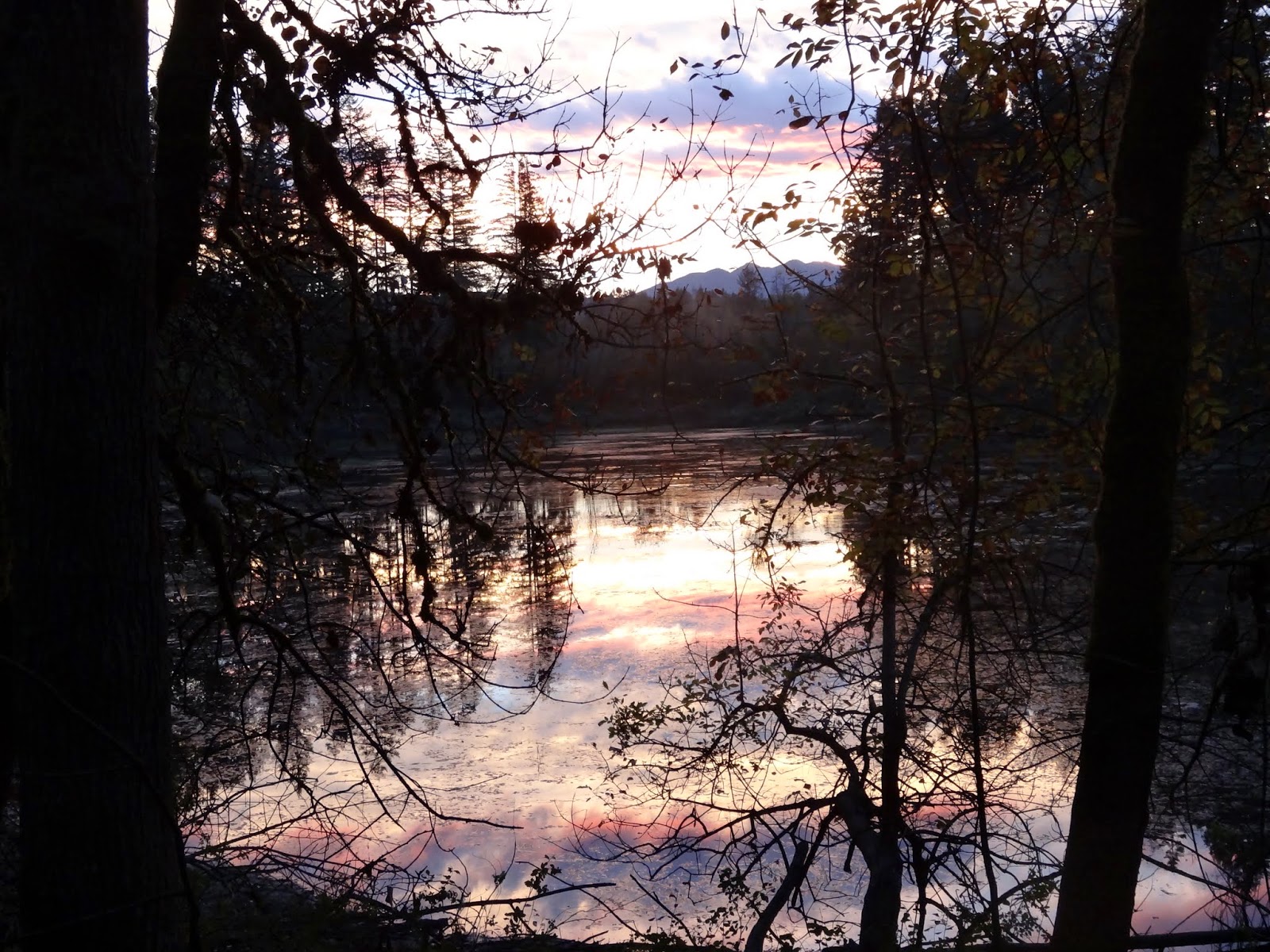
The picture below was taken just after getting over the top.
It was in the area of the "huge rocks" that 45 told me about.
The sun is starting to set.
Evening on the PCT - the trail goes through a rock slide. In the distance are the Goat Rocks
With darkness rapidly approaching, I scurried on down the trail.
Sure enough, there were no likely camping spots to be found.
I pulled out my iPhone and checked Guthook's data file, which shows mileage points on the trail, sources of water, and most importantly, camping spots.

The nearest camping spot was Hidden Springs, which was also a reliable source of water.

Even though I was almost running down the trail, darkness descended.
It was time to get out my headlamp, which, of course, was at the bottom of my pack.
But, I found it, turned it on (yes, it had good batteries), and got it mounted above my hat,

I continued on in the dark, watching and searching for the trail to Hidden Springs.
Before long, I found the trail and the camp ground.

To my surprise, the camp was filled entirely with PCT through hikers!

Several had already set up camp. Another group had arrived just before me and claimed a nice spot. They too were wearing head lamps.

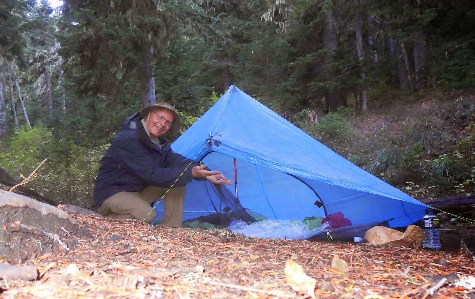
After several minutes of searching, I found a flat spot by a log and set up my tent in the dark. I ate a few bites of pizza that I brought with me, but I was too excited and exhausted to eat much.

I curled up in my sleeping bag and listened to the through hikers tell stories.

They were laughing and laughing about "mosquito-net guy". Apparently they met a guy who kept wearing a mosquito net, even though there were no bugs. He also acted funny, although I could not hear all of the details. Finally the conversation turned to food. Both of the guys said they could eat two dinners tonight, and still be hungry.

I fell asleep well after hiker midnight (9 PM). I was really excited about seeing the Goat Rocks!

The next morning, I woke at 6, had breakfast, and was on the trail by 7. I was hoping to talk to some of the through hikers, but they had talked and joked far into the night, and were still asleep.

Here is a picture of my tent site that I took the next morning:

My camping site at Hidden Springs
The trail provided easy walking since it was LOSING altitude. I must have walked for over an hour before heading up.

Along the way I passed several PCT hikers who were heading north. They were all friendly, but seemed in a hurry, so I didn't stop them to chat.

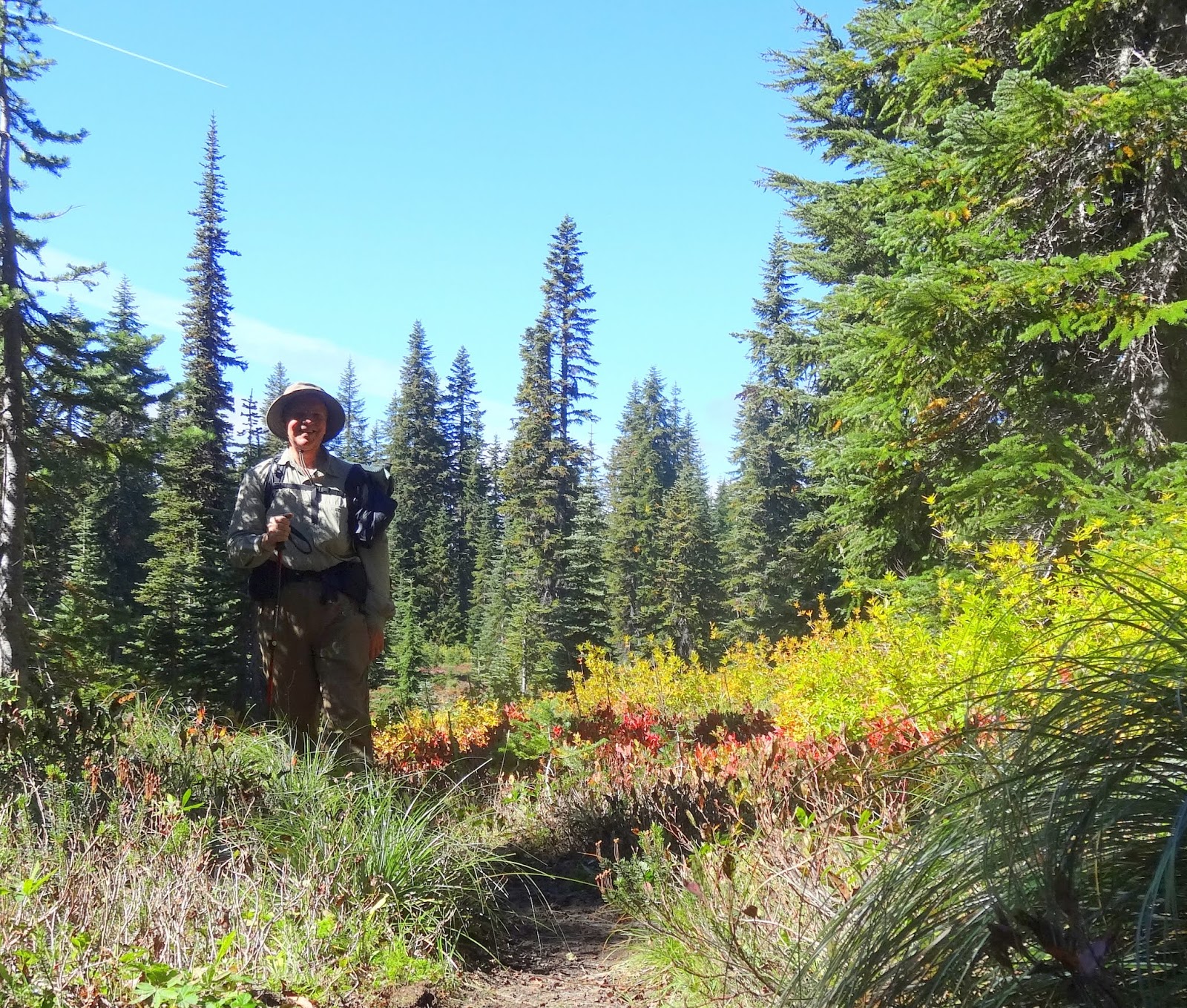
Once the trail started climbing it did so in earnest. I caught up with another gentleman who was headed the same way. We passed each other several times.

I tried to take a picture of me with a back drop of Mt. Rainier. I guess the camera really wanted to focus on the rock to the right. Oh, well...

Bob with a silly grin, not knowing that the camera really wanted to focus on the rock to the right.
The following picture shows the trail following the ridge-line up and up and up.
Old Snowy is the peak in the middle of the picture.

Trail heading up to the Goat Rocks. 
There were several through hikers heading down the trail, if you look closely.
They look like little ants!
Look closely, the hikers look like little ants on the trail!

The picture below shows what is called "the knife edge". The trail goes up (and down) following the very edge of the rocks. The wind was blowing really hard. At times it was hard to keep my balance. If I held up my trekking pole, it would blow out almost horizontally!

The Knife Edge in the Goat Rocks

The views were spectacular. The knife edge wasn't scary for me but others commented that it was the scariest thing they had ever done. The trail even crosses the top portion of the Packwood Glacier. There were a few other portions of the trail where rain had washed away the path, with only a sliver remaining to step on. A mis-step here would be disastrous!

I finally reached the top around 2 PM and headed down the other side. The fellow I had been walking with was headed to Snow Grass Flats, a popular camp ground about a mile off the PCT. I decided to head there.

I finally found a secluded camp spot not far from a rushing stream.
Mount Adams and Mount St. Helens dominated the skyline.

My legs were exhausted.
I had a good dinner, Mountain House Beef Stroganoff, to which I added slices of cheese. Yummy!

I curled up in my tent and listened to the hawks in the air as I fell into a peaceful sleep.

This was my camp site:
My secluded camp site at Snow Grass Flats.
The next morning, I was up by first light and on the trail by 6:45, heading back to White Pass.

This was my view of Mount Adams:
My view of Mt Adams from just above Snow Grass Flats
The hike back was strenuous on two accounts:

First, I had to hike back UP from Snow Grass Flats to the Goat Rocks, about 1500 feet.
Second, I had to hike back UP the mountain between Goat Rocks and White Pass, about 1500 feet.

But, I was determined.

What I discovered while hiking up those long stretches of trail was that much of the long-distance hiking is MENTAL. It was AWFUL when I looked up and saw the trail go on and on and on - up, up and up. It drained the energy from my legs.

I found that if I simply focused on the trail in front of me, and not on how much more there was to do, I was able to do it more easily. There were a few moments that I cursed at the PCT trail planners. They must have had an evil side to their planning with so may ups and downs!

As I passed above Shoe Lake, I met a forest ranger.
She asked me two questions:
1) Did you camp overnight? I said "yes" and told here where I had camped.
2) Do you have a wilderness permit? I said "yes", but she did not ask to see the copy.
She talked about seeing 5 groups of PCT through hikers and appeared to being headed towards Shoe Lake to ensure that no one was camping there.

I headed back down the trail, happy to have it mostly down-hill the rest of the way.

However, I did get careless. As the trail goes down and down, I found it easier to trot along; it was easier on my legs and feet. The problem came when I tripped on a root and did a face plant on the trail. It's one of those things I see in my mind in slow motion. I knew I was going down, and the pack seemed to ensure that I made a great "smack" when I hit.

Fortunately, I was not hurt, and missed a sharp rock by just inches.

I made it back to the trail head at 4 PM and was back home by 6. The shower never felt better!


Several things were first time events on this trip:
1) I left my Therm-a-rest sleeping pad at home and just used my sit pad. The sit pad worked great and I won't have to worry about getting an air leak anymore. The sit pad is also much quicker to set out and pack up.

2) I brought macadamia nuts for a lunch-time snack instead of candy. The nuts were salty and added a lot of protein and fat. The only problem is that their oil starts to go stale after a few days.

3) I walked the trail in the dark using my head lamp. I have used the head lamp on my walks before. It lighted up the trail really well, and the "red light" feature was nice to have while in my tent and sorting out my sleeping clothes.

4) I made camp among several groups of PCT through hikers. Oh, what fun. I chuckled at many of their stories. I can see where the people become a really important part of the hiking experience.

5) I did a "face plant" in the trail. I should have known better. I was lucky to have not gotten hurt or to have broken some of my equipment.

6) I saw the power of a "trail angel" to PCT through hikers. Wow, that guy was busy and having a blast. Perhaps that would be fun a few years down the line. I could give back to the hiking community.

7) I cursed the designers of the PCT in this section. I know there are reasons for putting the trail where it is. It's just that there are places there it seems pointless for the trail to go down when there are other obvious places where it could just follow the hillside instead.

8) I wore my new "Montrail Bajada" shoes for the first time. These shoes have a very large toe box and were great in climbing and going down the trail. They had good traction, good ventilation, and are very light. I did change my socks several times, which kept my feet drier.

9) I brought my down jacket liner that goes with by rain parka. It was so comfortable to wear it at night. And, it kept me warm during my bathroom breaks!

Below is a map of my first night, starting from White Pass and ending at Hidden Springs.

Map showing the PCT (green line) with the clear creek trail head and hidden springs.


Below is a map of my second day, starting from Hidden Springs and ending at Snow Grass Flats.
Second day - Hidden Springs to Goat Rocks (knife edge and below Old Snowy) to Snow Grass Flats
My final thoughts?
This was the most demanding hike I have ever taken.
I walk and hike a lot, but I really feel this one in my legs. There is a lot of elevation gain.
It is mentally and physically challenging. The mental part is the hardest.
This late in the season, water is a problem, especially on the first part of the trail.
Planning is critical.

This would be fun to do again just to meet the PCT through hikers.
They have SO MUCH insight by this time in their hike.
And their stories... Oh, do they have stories!


Sunday, August 10, 2014

The PCT - Chinook Pass north and south

My work schedule allows me to take off every other Friday, so this week I would have an extra day for an outing. With August weather being clear and warm, what could be better than a bonus day on the Pacific Crest Trail?

My plan was to get home from work, grab my pack, and drive to Chinook Pass, which is about an hour and twenty minutes from my house. I would get on the trail and hike NORTH to Sheep Lake. Depending on how long it took me to get there, I might hike on a bit further.
Trail head at Chinook Pass
I got to the trail at 5:30 PM and arrived at the lake at 6:30. Sheep Lake is a popular destination because it is a relatively short hike from Chinook Pass. It is also very beautiful, nestled between tall majestic mountains overlooking the Pacific Crest Trail.
Sheep lake from near Sourdough Gap

As I walked the trail shore, I noticed a man doing stretching exercises; he appeared to have just set up camp. His trail name was "Mungra", a through hiker who had been walking the PCT from the Mexican border. He had only walked sixteen miles today, saying that he felt like he had been walking uphill the whole way. He also said a lot of through-hikers were already in Washington because the snow was not a problem in the Sierras this year. He has hiked the PCT several times and said he might do it again next year.

Who knows, maybe I'll see him again on the trail?

Since there was a lot of daylight left, I decided to head up the trail to Bear Gap trail. The Bear Gap trail is where I started hiking about two weeks ago, when I headed north. I never did go south from the Bear Gap trail, because I was tired, and I didn't think I had enough time on my last trip.
On the Pacific Crest Trail at Sourdough Gap. See the trail crossing along the side of the hill?
A friendly marmot wonders who is hiking the trail at this time of the evening!

So, tonight, I headed north again. It ended up being six miles round trip, but I made it back to the lake by 8:30. I had just enough time to set up camp and eat dinner before dark.

As I snuggled in my warm sleeping bag, there was a bright moon lighting my tent. What a fabulous evening of hiking!
My tent at the Sheep Lake camp site. Campers must keep at least 100 feet away from the lake shore.

In the morning, I awoke at 5 AM and started packing up at 5:30. I didn't get a good sleep last night because there were strong gusts of wind all night. This morning, it is partly overcast, but a break in the clouds let the sun light up the mountain peaks above me. It was beautiful.

My plan for today was to hike SOUTH on the PCT. The elevation chart below shows the trail I traveled.


Note: This elevation chart courtesy of Guthook's PCT Hiker app. He has apps for many trails including the CDT and AT.

I got water at Sheep Lake, and then headed south on the trail. The trail follows along highway 410 for about a mile.
PCT has a view of highway 410. The pass is just to the left of the center of the picture.

I crossed over highway 410 on the log bridge, and then headed up the trail. The wild flowers were amazing. And, there were lots of little sparrows fluttering about, seemingly with no care in the world.
Wild flowers along the Pacific Crest Trail

Often I would see several chipmunks chasing each other, using the trail as their highway.

I reached the high point of my walk and could look down in the valley at Dewey Lake. This lake is a rather large lake, which sparkled in the sunlight, its deep blue color ringed by forest. I made a mental note that I would have to climb back up this 800 to 1000 foot  hill on my way back!
Dewey Lake in the valley below
The lake was lovely, and there were a couple groups camped there. On the way down, I passed a young couple. The woman had a mosquito net covering her head. I asked, "Lots of bugs down there?" and she replied, "No, I'm just paranoid!" I got a good chuckle out of that!
Dewey Lake from the trail. 
As I headed further south, I finally came to Anderson Lake, which is nestled in the forest and has several good camp sites. There was only one couple camped there, and it appeared that they were getting ready to hike out.

The trail steadily rises and I came to the trail junction to American Lake. There was a group of young men there, who had apparently hiked up from American Lake. The signage for the PCT is not good at this point. There is nothing identifying the PCT, other than a faint scribble on the sign that was likely added by some through hiker to help others on the trail. I wonder why they don't at least put up some of the PCT trail emblems at such junctures? I checked my Guthook trail map with my GPS to make sure I was still on the right trail. There would be nothing worse than to hike uphill for a mile or two and realize you were on the wrong trail!

The trail continued its steady climb and I was feeling the miles on my legs. At one point, I happened to take my eyes off the trail and look out at the surrounding view. Mount Rainier was awesome! The views were absolutely spectacular!
Spectacular views of Mount Rainier
At about nine miles in, I decided to break for lunch, air out my feet, and change socks. As I was eating a cup of peanut butter, an older gentleman with a cowboy hat comes walking out of the woods and onto the trail. He asked me if I had seen two kids, one carrying an orange backpack. When I asked how old the kids were, he remarked, "they're in their mid 40's"! He had apparently hiked ahead this morning, complaining about being cold. But, in the sun, he decided to hike off trail and take a nap! He said he left his hiking pole in a tree branch beside the trail, so his "kids" would know he was there. I thought to myself, "I didn't see your black hiking pole, why would you think they would?" Anyway, I hadn't seen his companions, but told him I would let them know where he was if I did. As it turned out, I met them about twenty minutes down the trail. The backpack he described was red, not orange.

As I headed back, I met more an more hikers. This is a popular hike, and now I know why. The views are priceless, and starting the trail at the pass makes it easy to enjoy the trail.

I got back to Chinook Pass at 3 PM. I figured that I hiked over twenty miles today.

I headed back toward home, but stopped for dinner at the Black Diamond Pizza and Deli.

Pizza and beer - yummy, yummy, yummy!

Saturday, July 26, 2014

My first 26 miles on the PCT

I fell in love today.
I fell in love with the PCT.

 I awoke at first light and looked out over the lake.
The sky was blue and soon the sun kissed the mountain tops.
The morning was all blue sky & sunshine!


I was on the trail at 6 and my feet touched the PCT at 6:20.

PCT trail sign at the junction with the Bear Gap trail.

The views just kept getting better and better. Mount Rainier framed the skyline.
Bob's shadow and Mount Rainier towering over the trail.

As I headed north and gained elevation I could see for miles.
Mount Adams towered in the distance.

Mount Adams in the distance.

I walked through field after field of wild flowers.
I was in love.
A deer bounded from the trail and headed to the meadows.
I saw a deer off in the field. Several elk dashed through the forest.

By 2 PM I reached the Urich shelter.
Urich cabin. Lots of through hikers on the PCT stay here in the wet rainy September and October months.

I had walked over 18 miles just on the PCT. I soaked my feet and changed my socks.
Lunch was a protein bar and peanut butter.

The hut is near the jeep road (Naches trail).
Lots of people started showing up, so I decided to head back and camp at the junction with the Arches trail.

My camp after walking 26 miles on the Pacific Crest Trail.
In all, I walked about 26 miles today.
It's a new record for me.

The sun is still shining.
The trail has touched my soul.
I am in love, and it feels wonderful!